The local story
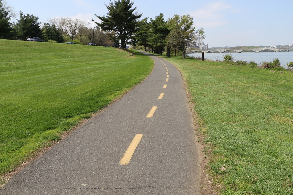
Trent was continuing one of his favorite routes: Potomac Yard to Crystal Drive, through the bike lanes by Reagan National Airport, then north toward Washington. At Gravelly Point, the familiar Mount Vernon Trail suddenly moved left. Fences and concrete barriers occupied the old line. Beyond them were project signs, cranes, barges, railroad tracks, Metro tracks, and enough parallel bridges to make the construction difficult to read at a glance.
The detour is the small, local piece. The larger answer is the Long Bridge Project—a 1.8-mile rail expansion between Arlington and L’Enfant Plaza that adds five rail bridges, two walking-and-biking structures, and a continuous four-track corridor. To understand what is happening from the trail, start with two questions: Why did the path move, and what exactly are they building beside all those existing bridges?
The detour
The trail moved because crews need the riverbank to build two new bridges.
VPRA’s updated advisory put the detour into effect on or about July 15, 2026, replacing an earlier June schedule. The temporary route shifts approximately one-quarter mile of the Mount Vernon Trail from north of Gravelly Point toward the northbound I-395 bridge. It is paved, lighted, and expected to remain in place through construction, currently scheduled through 2030.
The former alignment is now part of the shoreline work zone for foundations serving two separate Potomac crossings: a new two-track railroad bridge and a dedicated bicycle-pedestrian bridge. The temporary route moves trail users toward the George Washington Memorial Parkway, passes beneath existing bridges, and reconnects north and south of the construction area. Concrete barriers separate the narrowed trail from vehicle activity beneath the bridges.
One point deserves attention without turning it into drama. The detour crosses a construction access road used to move crews, equipment, and materials between the parkway and the shoreline. VPRA asks everyone to slow down, follow signs and on-site directions, and stay outside the work zone; bicyclists are encouraged to dismount and walk through that crossing. VPRA says the original trail segment will be restored in an improved condition when the project is complete.

The river crossings
They are adding two bridges beside the old railroad bridge—not replacing it.
From south to north—also moving upriver—the order is: the existing Long Bridge; the new two-track railroad bridge; the new bicycle-pedestrian bridge; Metro’s existing Charles R. Fenwick Bridge for the Yellow Line; and then the three highway spans of the 14th Street bridge complex. Those highway bridges are the Arland D. Williams Jr. Memorial Bridge, Rochambeau Memorial Bridge, and George Mason Memorial Bridge.
The existing Long Bridge dates principally to 1904, with major strengthening work completed in 1942. It remains a CSX-owned railroad bridge. The project preserves it and builds the new two-track railroad span immediately to its north. The eastern pair of tracks—the existing bridge—will be used primarily by CSX freight. The western pair—the new bridge—will be used primarily by Amtrak and VRE passenger trains. VPRA’s procurement documents are careful on one point: all four tracks are designed for interoperability when operations require it. ‘Primarily’ does not mean ‘exclusively.’
The bicycle-pedestrian bridge is a third, independent structure between the new railroad bridge and Metro’s Yellow Line bridge. Its current design provides 16 feet of clear width and connects Long Bridge Park and the Mount Vernon Trail in Arlington with Ohio Drive SW in East Potomac Park. VRE is not moving onto Metro tracks, Metro is not becoming part of the railroad corridor, and the historic Long Bridge is not being converted into a trail.
There is already a walking-and-biking crossing in the nearby 14th Street bridge complex, associated with the George Mason Memorial Bridge. VPRA’s FAQ says that crossing will not be affected and is not part of the Long Bridge Project. The new trail bridge adds another Potomac route; it does not remove the existing one.
The larger project
The Long Bridge Project is seven bridges, not two.
The two structures visible from Gravelly Point are only the southern end of a 1.8-mile corridor. VPRA’s current project description lists five rail bridges: the new two-track bridge over the George Washington Memorial Parkway and Potomac River; a new two-track bridge over the WMATA portal and I-395; and new four-track bridges over Ohio Drive SW, the Washington Channel, and Maine Avenue SW.
The other two structures are for people on foot or bicycle: the dedicated Potomac River bridge and a replacement pedestrian bridge over Maine Avenue SW. That Maine Avenue bridge serves a separate local connection near the hotel and marina area. It does not connect to the new Potomac trail bridge.
Today, CSX freight, Amtrak, and VRE share a two-track Potomac rail crossing that VPRA says operates at 98% capacity during peak hours. Four continuous tracks add capacity, but the practical value is not simply ‘twice as many tracks.’ The layout gives operators more room to separate passenger and freight movements, recover from delays, route around work or disruptions, and avoid making every train compete for the same two rails.
The current official budget is also higher than the older $2.3 billion figure still attached to some descriptions. VPRA’s April 2026 FY27 budget lists $1.6484 billion for Long Bridge North and $1.0163 billion for Long Bridge South, totaling approximately $2.6647 billion. That is the present project budget, not a guaranteed final cost. A $729 million Federal Railroad Administration grant supports Long Bridge and the other Phase II Transforming Rail in Virginia projects; it is not a grant solely for this bridge. A separate $20 million RAISE grant specifically supports the bicycle-pedestrian crossing.
What the equipment is doing
The barges at Gravelly Point are building foundations for a project scheduled through 2030.
The cranes and barges are not repurposing the historic bridge. They are staging marine construction, building shoreline bulkheads, driving and testing piles, and installing the foundations that will carry the new structures. A bulkhead is a retaining wall at the water’s edge. A pile is a long structural element driven into the riverbed to transfer the bridge’s weight into stronger soil or rock below.
Before crews commit to a full foundation system, they test how the ground responds. VPRA’s July construction update said the project had completed its test-pile program, including pile driving and Statnamic tests on June 16 and 19. Statnamic testing applies a brief, controlled load to a pile and measures its response. The result helps engineers confirm how the permanent foundations should be built. The same update described ongoing excavation support, abutment preparation, foundation-pile work, and marine construction on both sides of the river.
The August 2026 marine notice shows the river work moving beyond a temporary test. Warning buoys now mark active construction areas, no-wake zones, and a navigable channel through the Potomac work area. Barges and equipment may move, and VPRA says marine traffic could temporarily shift to an auxiliary channel with advance notice. The channel remains an operating waterway, not a closed construction basin.
VPRA’s August 20 advisory adds the newest shoreline detail: equipment placement and bulkhead construction on the Washington side are continuing, with intermittent Ohio Drive traffic controls currently scheduled from late August 2026 through March 2027. That advisory does not change the trail detour’s current 2030 timeframe.
The schedule is currently expected to run through 2030. That date should be read the same way as the budget: it is the latest official plan, not a promise insulated from weather, river conditions, railroad operations, design coordination, or construction discoveries. For anyone passing Gravelly Point now, the clearest evidence of the project is still the detour. The permanent story is being built just beyond the fence, mostly below the waterline.
Why this matters locally
A familiar recreational and commuting route is temporarily changing because Northern Virginia and Washington are creating more railroad capacity, better day-to-day separation of passenger and freight operations, and a new dedicated Potomac crossing for people walking and biking. The detour is inconvenient by design: it keeps the trail operating while the foundations occupy the old riverbank. What replaces that work zone is not one mystery bridge, but a clearer set of separate connections—rail beside rail, trail beside rail, and Metro remaining exactly where it is.
Sources and further reading
Where the reporting comes from.
This article draws on public records, official statements, and attributed local reporting. Each link opens the original source.
- VPRA: Long Bridge Project overview and current budget ↗
- VPRA: updated Mount Vernon Trail detour advisory, July 9, 2026 ↗
- VPRA: Long Bridge and Mount Vernon Trail detour fact sheet, June 2026 ↗
- VPRA: Long Bridge monthly construction update, July 2026 ↗
- VPRA: Potomac River notice to mariners, August 2026 ↗
- VPRA: FY27 budget presentation, April 2026 ↗
- VPRA: Long Bridge North procurement description and four-track interoperability ↗
- VPRA: Long Bridge Project FAQ, July 2023 ↗
- National Capital Planning Commission: Long Bridge layout and historic-design review, July 7, 2022 ↗
- National Park Service: Mount Vernon Trail overview ↗
- VPRA: $729 million federal grant for Long Bridge and other Phase II rail projects ↗
- VPRA: $20 million RAISE grant for the bicycle-pedestrian crossing ↗
- VPRA: Ohio Drive shoreline work and bulkhead construction advisory, August 20, 2026 ↗