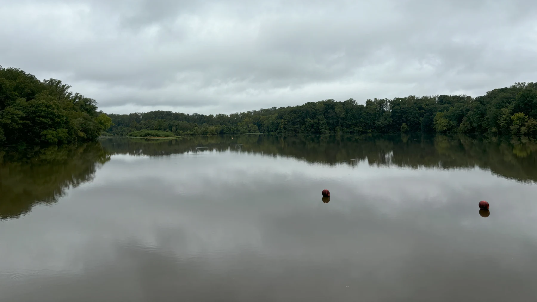
The local story
Lake Accotink has the trails. Lake Barcroft has the waterfront neighborhood. Lake Anne has the plaza where buildings, people and water meet. They feel like pieces of Northern Virginia that were always there. But the better question is: why is the water there in the first place?
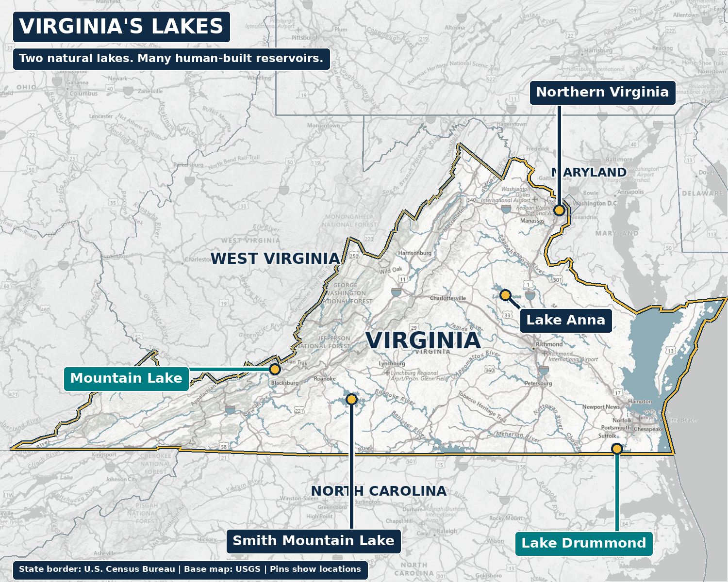
Virginia’s water-quality standards identify just two natural lakes: Lake Drummond in the Great Dismal Swamp and Mountain Lake in Giles County. Neither is in Northern Virginia. Many of our familiar lakes were built for drinking water, military needs, fishing, electricity or community planning. Man-made does not mean fake. It means someone had a reason to hold the water back.
This is a tour of 13 important and familiar lakes, rather than a complete inventory of Virginia’s reservoirs. Start close to home, then follow the story outward. A lake’s birthday might mean a dam was built, water began filling a valley or a park opened. Keeping those events separate makes the history much more interesting.
13 lakes, at a glance
Dates identify the event, rather than treating dam construction, filling and park opening as the same milestone. Each lake’s sources appear in its section below.
| Lake | Location | Natural or man-made | Origin or key date | Original purpose |
|---|---|---|---|---|
| Lake Barcroft | Fairfax County, near Seven Corners | Man-made | 1915 reservoir; neighborhood development from 1950 | Alexandria drinking water |
| Lake Accotink | Springfield, Fairfax County | Man-made | 1918 first dam; dismantled 1922; present reservoir early 1940s | Army drinking water |
| Burke Lake | Fairfax Station, Fairfax County | Man-made | Began filling 1961; park opened May 25, 1963 | Public fishing |
| Occoquan Reservoir | Between Fairfax and Prince William counties | Man-made | 1950 low dam; larger dam 1957 | Drinking-water storage |
| Lake Anne | Reston, Fairfax County | Man-made | 1962 impoundment; village center opened 1965 | Planned waterfront village and recreation |
| Lake Thoreau | South Reston, Fairfax County | Man-made | 1971 impoundment | Community recreation and watershed system |
| Lake Audubon | South Reston, Fairfax County | Man-made | 1979 impoundment | Community recreation and watershed system |
| Lake Newport | North Reston, Fairfax County | Man-made | 1981 impoundment | Community recreation and watershed system |
| Lake Fairfax | Reston area, Fairfax County | Man-made | 1958 dam proposal; lake created before county acquisition in 1966 | Private recreation area |
| Lake Drummond | Great Dismal Swamp, southeastern Virginia | Natural | About 4,000 years ago, according to USFWS’s peat-fire explanation | No human construction purpose |
| Mountain Lake | Giles County, western Virginia | Natural | Natural geological basin; no construction date | No human construction purpose |
| Lake Anna | Louisa, Orange and Spotsylvania area | Man-made | Dam gates closed January 1972; full level December 1972 | North Anna Power Station cooling water |
| Smith Mountain Lake | Roanoke River, southwestern Virginia | Man-made | Construction 1960; dams completed 1963; full level 1966 | Hydroelectric generation and pumped storage |
The basic answer
What “two natural lakes” actually means.
The official distinction concerns origin. Virginia defines a natural lake as an impoundment that formed naturally and names Mountain Lake and Lake Drummond. An impoundment is simply water held in a basin; for a constructed lake, a dam usually does the holding. A reservoir is stored water that can serve a purpose such as drinking supply or electricity generation.
A wooded shoreline does not settle the question. Trees, fish and decades of neighborhood life can make an engineered reservoir feel entirely natural. Conversely, a natural lake can have a complicated history of human use and management. The label explains how the basin began, rather than how beautiful or ecologically valuable it is.
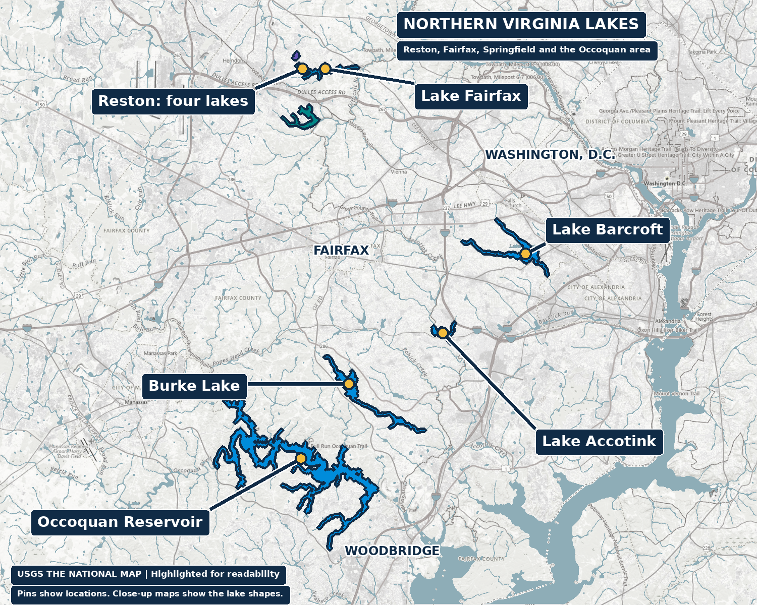
The map also explains why the claim surprises people here. The two officially identified natural lakes are far from the Northern Virginia places most of us picture first. Around Fairfax, Springfield, Reston and the Occoquan, the visible water often records a decision about what the region needed.
Lake Barcroft
A drinking-water reservoir became a waterfront neighborhood.
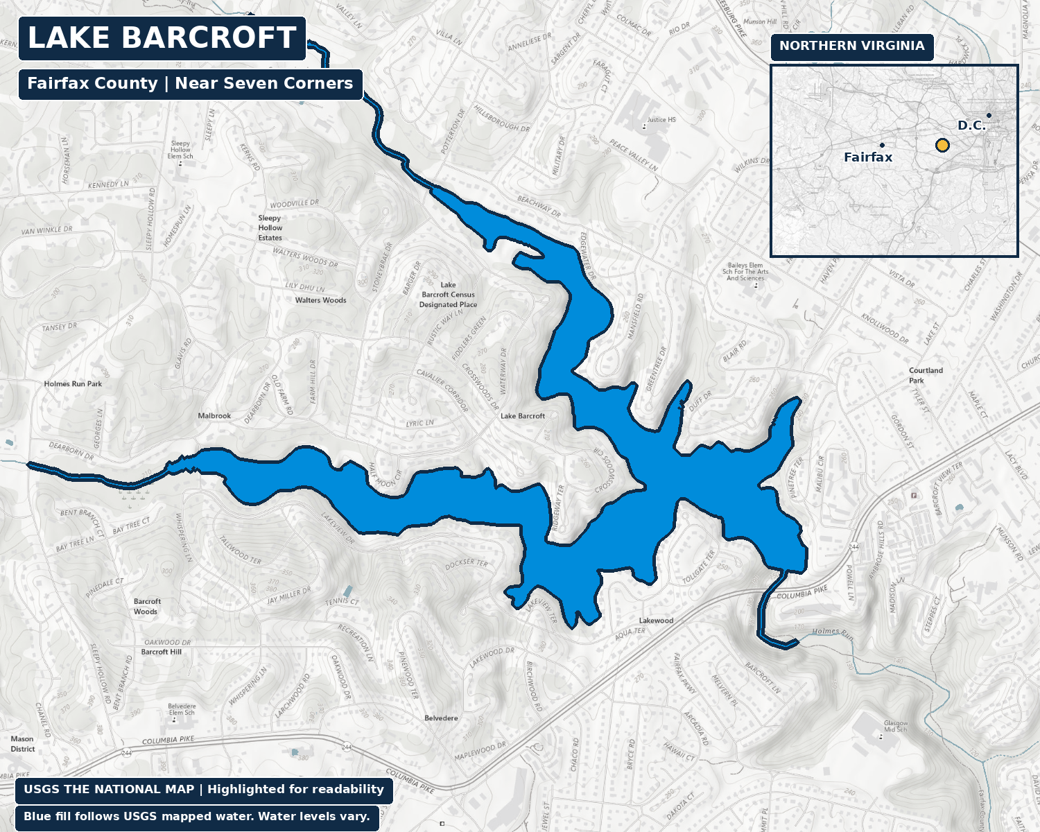
Near Seven Corners and Bailey’s Crossroads, Lake Barcroft began in 1915 as the Alexandria Water Company’s answer to rising demand for drinking water. Its dam stored water from Holmes Run and the branch now called Tripps Run. Dam construction had started in 1913. The lake came first; the residential community came much later.
The association’s history records a change in 1942, when gates raised the spillway and increased storage. By the late 1940s, other sources had replaced the reservoir’s water-supply role. Developers bought the lake and surrounding land in 1950, and homesite sales and community construction followed that year. The familiar neighborhood grew around retired water infrastructure.
That sequence changes the view from the shore. These homes did not simply discover a natural lake. A utility created the water, and a later development decision made it the center of a community. The association’s account describes exclusive community use of the lake and beaches, so a lake on the map should not be read as a public waterfront park.
Lake Accotink
The Army made a lake, removed it and made it again.
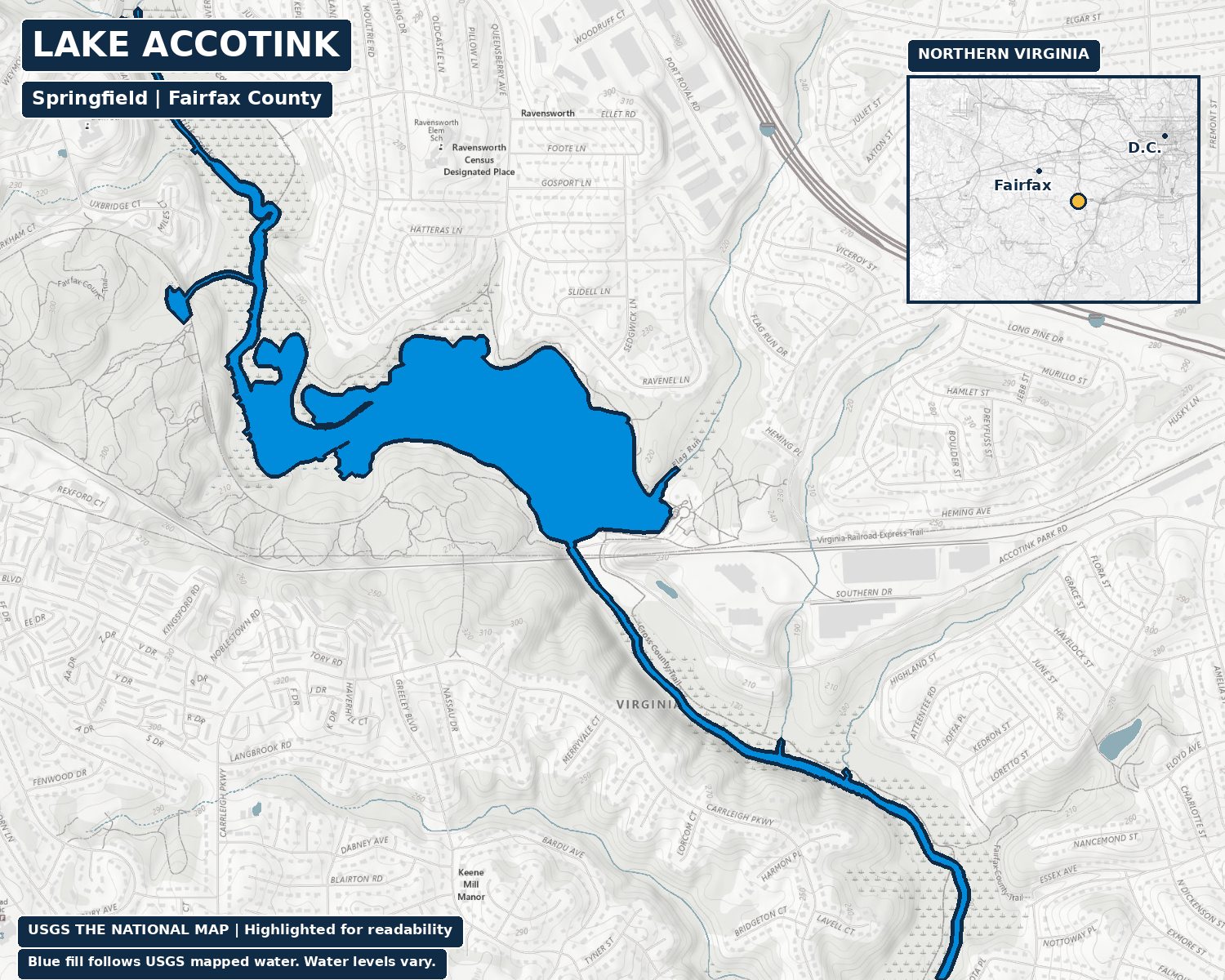
In Springfield, the first Lake Accotink was a military water-supply project. The War Department dammed Accotink Creek in 1918 to supply the Army installation known as Camp A. A. Humphreys, now Fort Belvoir. The Park Authority’s historical account says the first dam was dismantled in 1922 because of concern for the railroad trestle. That is more specific than saying it simply failed in a storm.
The present reservoir belongs to the early 1940s, but county sources disagree on the exact replacement date. The current Public Works background uses 1940; the Park Authority’s master-plan history says reconstruction occurred in 1943. Both describe the same essential purpose: another Army drinking-water source. This story preserves that disagreement rather than turning an uncertain year into a settled anniversary.
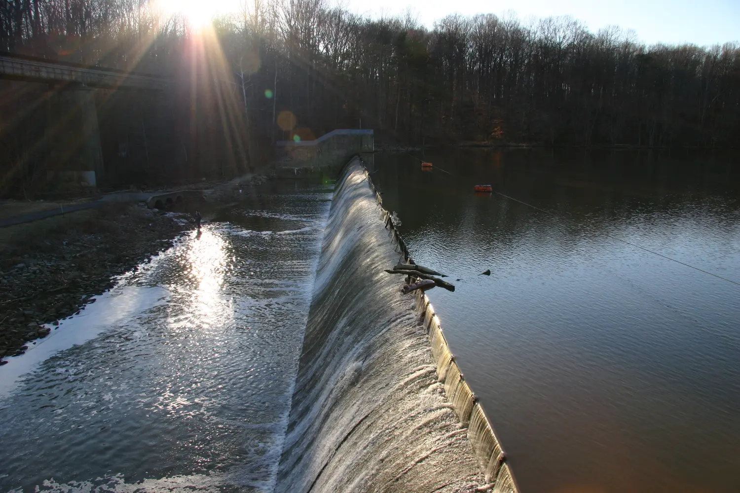
The dam and railroad bridge make that layered history unusually visible. The county began leasing federal land for the park in 1960 and bought the previously leased acreage in 1965. Trails and neighborhood recreation grew around infrastructure built for a different job. A walk past the spillway is also a walk past the mechanism that keeps the lake there.
That dependence continues. The county’s August 25, 2026 update describes modeling smaller lake alternatives, rather than a final adopted shoreline. Sediment management and dam work remain part of the preservation question. The detailed future of the lake deserves its own story; this one explains why there was an engineered lake to preserve in the first place.
Burke Lake
The lake was the recreation project.
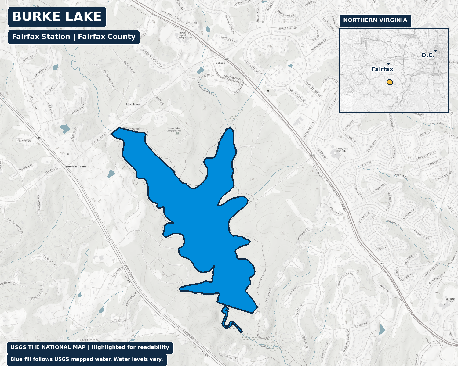
Burke Lake, off Ox Road in Fairfax Station, flips the Barcroft story. It was created as a public fishing lake, rather than a water-supply reservoir that later found a recreational use. The Fairfax County Public Library’s historical photograph record describes local fishing and conservation groups advocating for a lake in the late 1950s. It began filling in 1961 after dam construction.
Burke Lake Park opened on May 25, 1963, a date also documented in the Park Authority’s annual report. Those are two separate milestones. Filling a new lake and opening the surrounding park did not happen in the same instant. Calling 1963 the lake’s construction year would erase part of the story.
There is also an ownership distinction easy to miss from the trail: Virginia’s Department of Wildlife Resources owns the public fishing lake, while Fairfax County operates the surrounding park. DWR describes active fisheries management, including added fish habitat and biological sampling. The scenery and the fishery are both managed resources. That makes the lake a useful example of recreation shaping a landscape from the beginning, with different agencies responsible for its different pieces.
Occoquan Reservoir
The lake in the view is also water in the system.
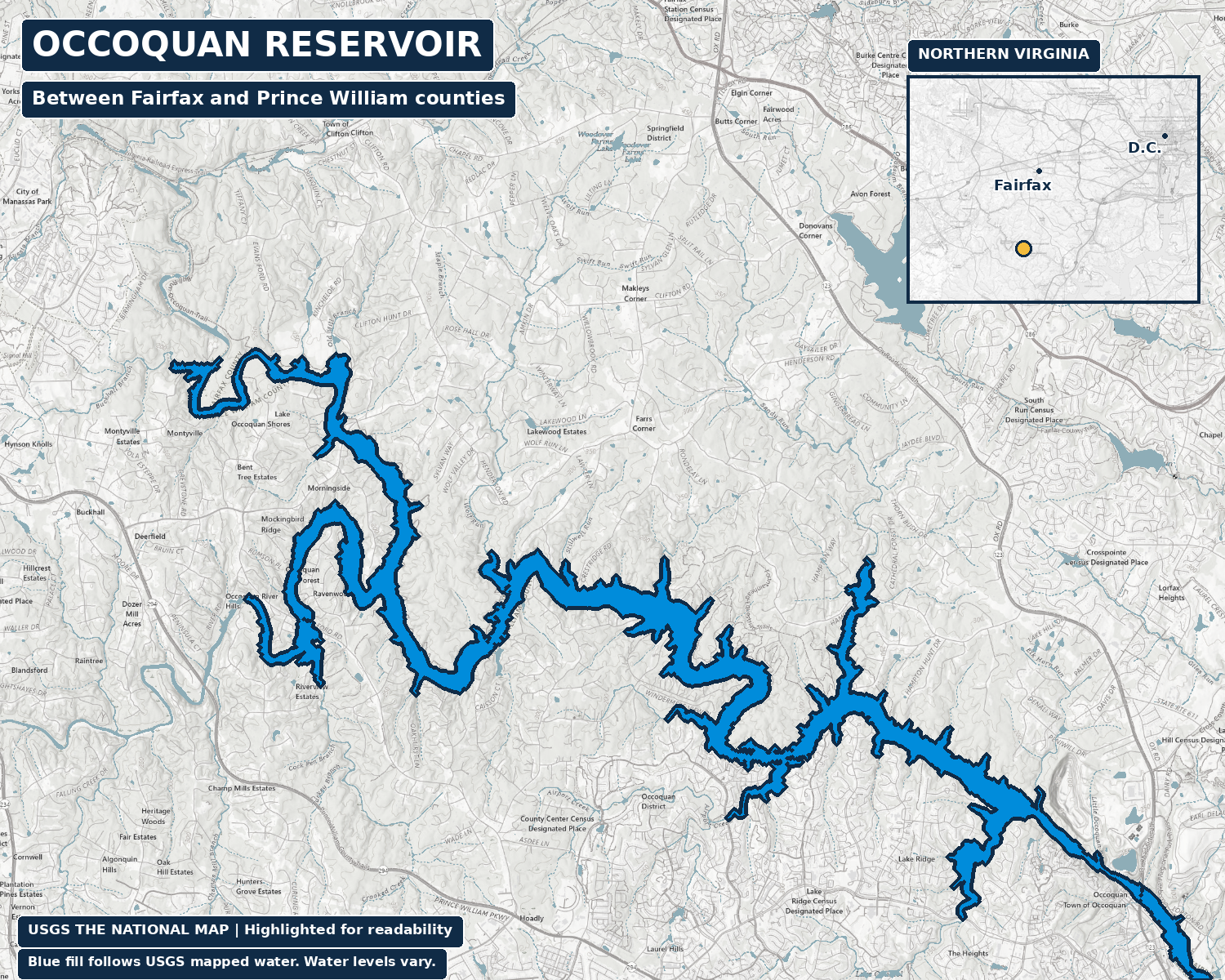
Along the boundary between Fairfax and Prince William counties, the Occoquan Reservoir is a recreational landscape with a continuing utility job. The Northern Virginia Regional Commission’s watershed history records the Alexandria Water Company building a low dam on the Occoquan River in 1950. A larger Upper Occoquan Dam followed in 1957 to provide more storage as the service area grew.
The same history records transfer of the dam and treatment facilities to the Fairfax County Water Authority in 1967. That ownership change was not the reservoir’s birth. The initial dam, larger dam and later transfer belong to different parts of the chronology.
Its long, branching shape is a reminder that a reservoir follows existing valleys. Water arrives from a much larger watershed, meaning the land that drains toward it. What happens upstream can influence the water downstream. Seen that way, the shore is one edge of a regional water-supply system, rather than the boundary of the story. The drinking-water purpose helps explain why a place people enjoy from a boat also requires attention to surrounding growth and water quality.
Reston’s four lakes
Water became part of the neighborhood plan.
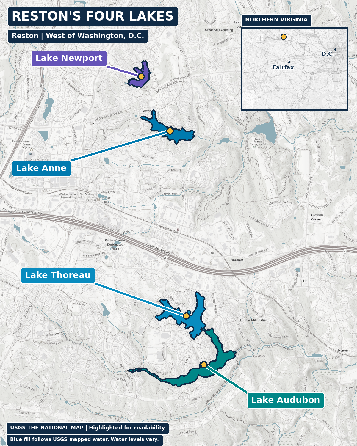
Reston’s Lake Anne, Lake Thoreau, Lake Audubon and Lake Newport are all constructed lakes. Reston Association describes them as recreation spaces and impoundments within the Difficult Run watershed. They catch water from Colvin Run, Snakeden Branch and tributaries. They belong to community life and a drainage network at the same time.
The association’s 2024 State of the Environment Report labels its dates specifically as years impounded: Anne in 1962, Thoreau in 1971, Audubon in 1979 and Newport in 1981. Those dates describe holding water, not the opening of every nearby building. The four lakes share a planned-community setting, but their size, drainage and relationships are different.
Lake Anne: the waterfront village
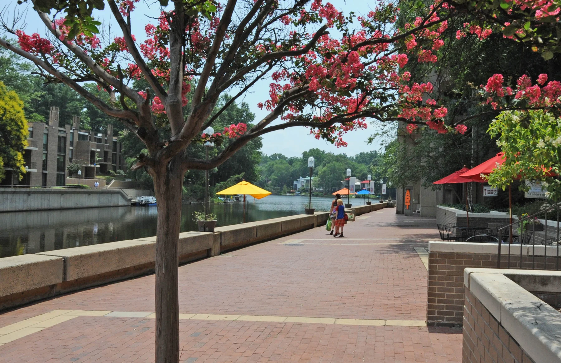
Lake Anne is the oldest of the four, with a 1962 impoundment year in the association’s report. Robert E. Simon bought the land for Reston in 1961. Fairfax County describes Lake Anne Village Center as the first village center and dates its opening to 1965. The lake date and plaza opening therefore tell different parts of the same development story.
Whittlesey and Conklin’s village design brought homes, offices and shops together at pedestrian scale around water and a plaza. Here the lake helped organize a social place. It also sits in a connected water system: the association’s monitoring report describes Lake Newport overflow entering Lake Anne and Anne’s discharge continuing toward Lake Fairfax.
Lake Thoreau: a smaller drainage area
In South Reston, Lake Thoreau was impounded in 1971. The association’s environmental monitoring report highlights its relatively small drainage area compared with its lake surface, which helps explain its comparatively good water quality. It receives runoff from less surrounding land per unit of water surface than a lake with a larger drainage ratio.
That distinction is useful even without memorizing measurements. Two lakes in the same community can face different pressures because of what drains into them. Thoreau’s history includes neighborhood recreation, but its continuing condition also reflects the geometry of the watershed around it.
Lake Audubon: the larger watershed
Lake Audubon, also in South Reston, was impounded in 1979. The association’s environmental summary identifies it as the largest of Reston’s four lakes and the one with the largest watershed. More land draining toward a lake can mean more opportunities for sediment and nutrients to arrive with runoff.
Audubon makes the infrastructure side of the neighborhood landscape easier to understand. A lakeside view and a drainage function coexist. Protecting the water involves land farther from the shore, not just the people whose backyards touch it.
Lake Newport: upstream of Lake Anne
North Reston’s Lake Newport was formed in 1981 by holding back an unnamed tributary of Colvin Run. Its overflow flows downstream into Lake Anne. It is the newest of the four lakes, and its upstream position means the lakes are connected physically as well as by community identity.
Reston Association describes lake recreation for members and guests and prohibits swimming in its lakes. The attractive waterfront setting should not be mistaken for unrestricted public access or a swimming designation. A neighborhood’s water has rules and responsibilities as well as a view.
Lake Fairfax
A private recreation lake came before the county park.
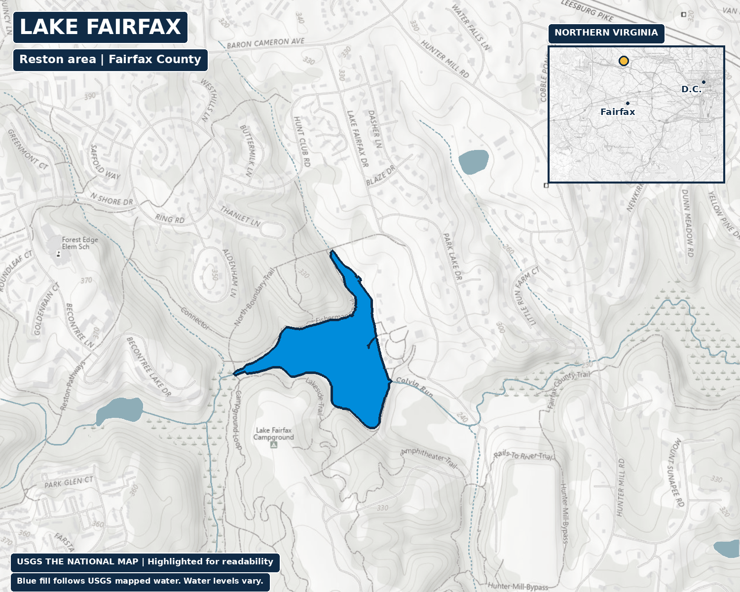
Lake Fairfax sits in the Reston area, but it has a different origin from Reston Association’s four lakes. The Park Authority’s 2001 master-plan report describes Mack S. Crippen Jr. and Irene B. Crippen assembling property from land inherited from J. A. Wheeler. Mack proposed a dam in 1958 to create a lake for a recreational property.
The report then says the lake was created and the Crippens developed the land as a recreation area. It does not give a separate, precise completion date for the dam. The core property went to the Park Authority in 1966. A 1958 proposal, subsequent lake creation and 1966 acquisition are a sequence, not three interchangeable birthdays.
The earlier land history adds another layer: Wheeler had proposed a commercial airstrip on land where the report locates athletic fields. The landscape could have taken a very different direction. Instead, a private recreation venture became part of the county park system. Today’s lake setting carries both those changes in land use and the practical work of managing water, sediment and habitat.
The two natural lakes
One in a swamp, one in the mountains.
Now leave Northern Virginia. Virginia’s two officially identified natural lakes are not near each other, and they do not share one neat origin story. Lake Drummond belongs to a low, forested swamp in the southeast. Mountain Lake sits in a western Virginia geological basin. Both reward a little more care than a simple natural-versus-man-made caption.
Lake Drummond: peat, fire and dark water
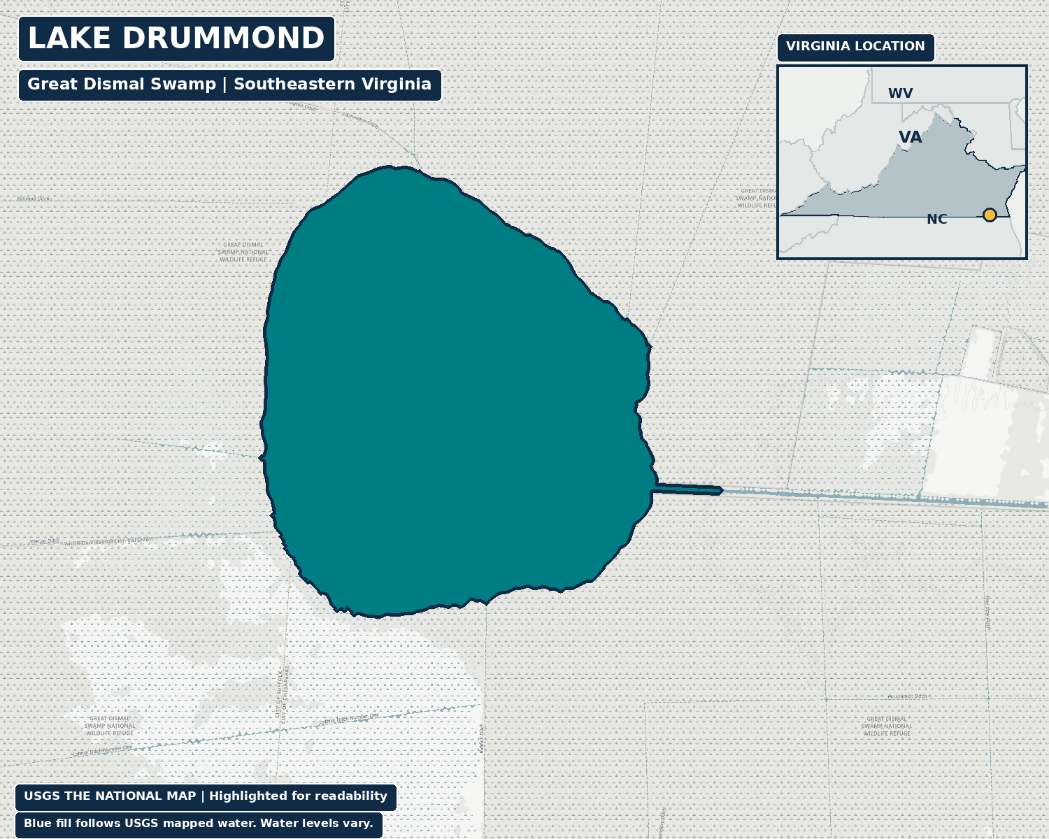
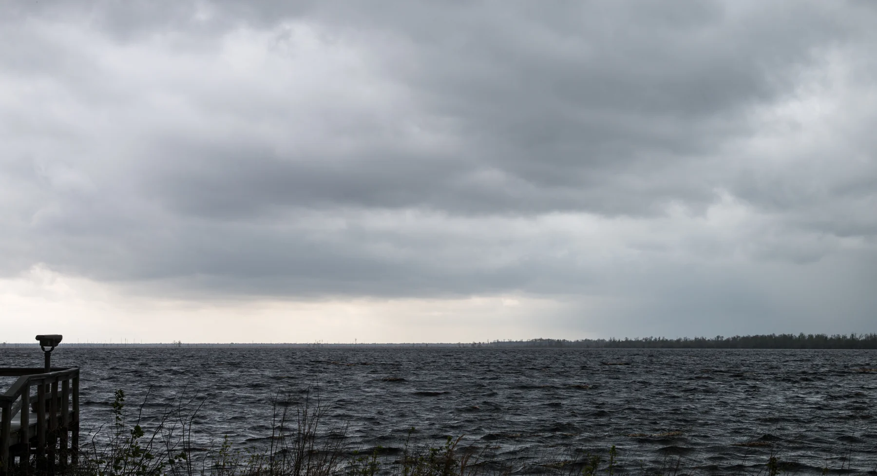
Lake Drummond lies within the Great Dismal Swamp in southeastern Virginia, in the Chesapeake and Suffolk area. The U.S. Fish and Wildlife Service’s 2022 Wildlife Drive brochure attributes its formation about 4,000 years ago to a fire that burned away several feet of peat soil. Peat is accumulated organic material from vegetation. That is an attributed refuge explanation, rather than a claim that every question about the basin’s origin is settled.
The brochure also explains the water’s dark brown color through the swamp’s peat. Water moving through organic material can take on that tea-colored appearance. Darkness alone is not evidence that the water is polluted; color needs its local environmental context.
The surrounding refuge also has a long human history of drainage and timber extraction. The agency now describes hydrological restoration, forest management and fire management as conservation priorities. A natural origin does not mean the wider landscape escaped human intervention. Here the lake belongs to a wetland system with its own ecological and cultural history.
Mountain Lake: a basin that can lose its water
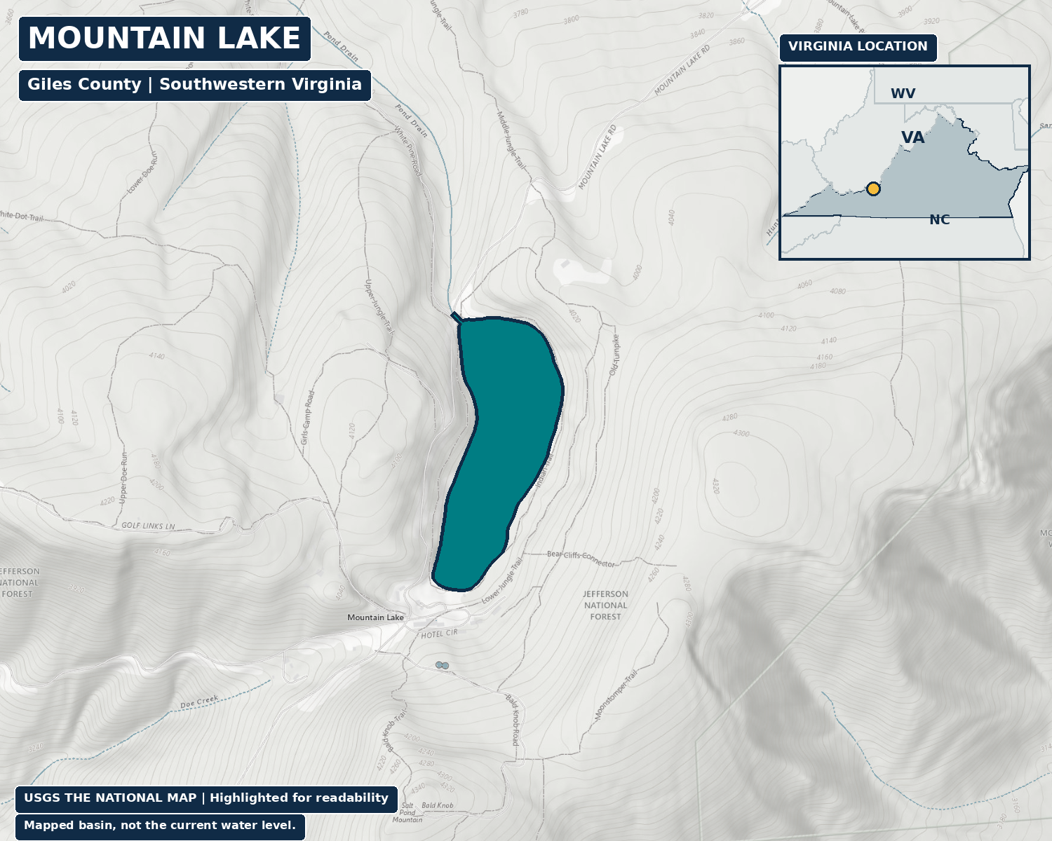
Mountain Lake is in Giles County near Pembroke, far west of Northern Virginia. Virginia Tech researcher Jon Cawley’s 1999 study interpreted natural rock movement as the initial damming mechanism and described a leaky underground discharge pathway. Geological explanations should stay attached to the research that developed them, rather than being flattened into one certain landslide date.
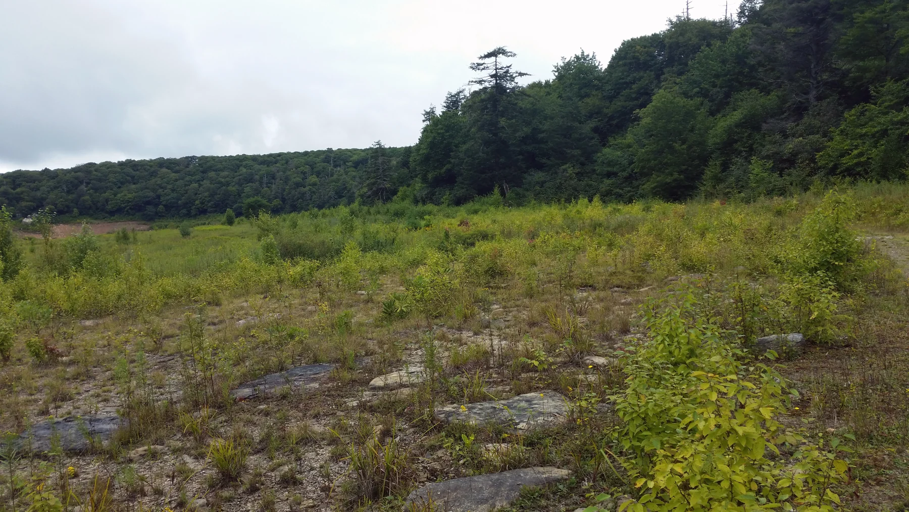
Jeanne Marie Roningen’s 2011 Virginia Tech study examined groundwater flow and large changes in lake level. Its abstract says the lake was about 2 percent full by volume in December 2010. That is a historical observation, not a report of its level today. The research describes underground drainage and recharge, making the changing balance between incoming and outgoing water central to understanding the basin.
The setting also has a recognizable movie connection. Virginia Tourism identifies Mountain Lake Lodge in Pembroke as a major filming location for Dirty Dancing. The resort connection does not mean every scene was filmed there. Nor does a familiar film image, a historical photograph or a mapped water outline establish how full the lake is now. Read the date along with the picture.
Lake Anna
Cooling water became a major recreational landscape.
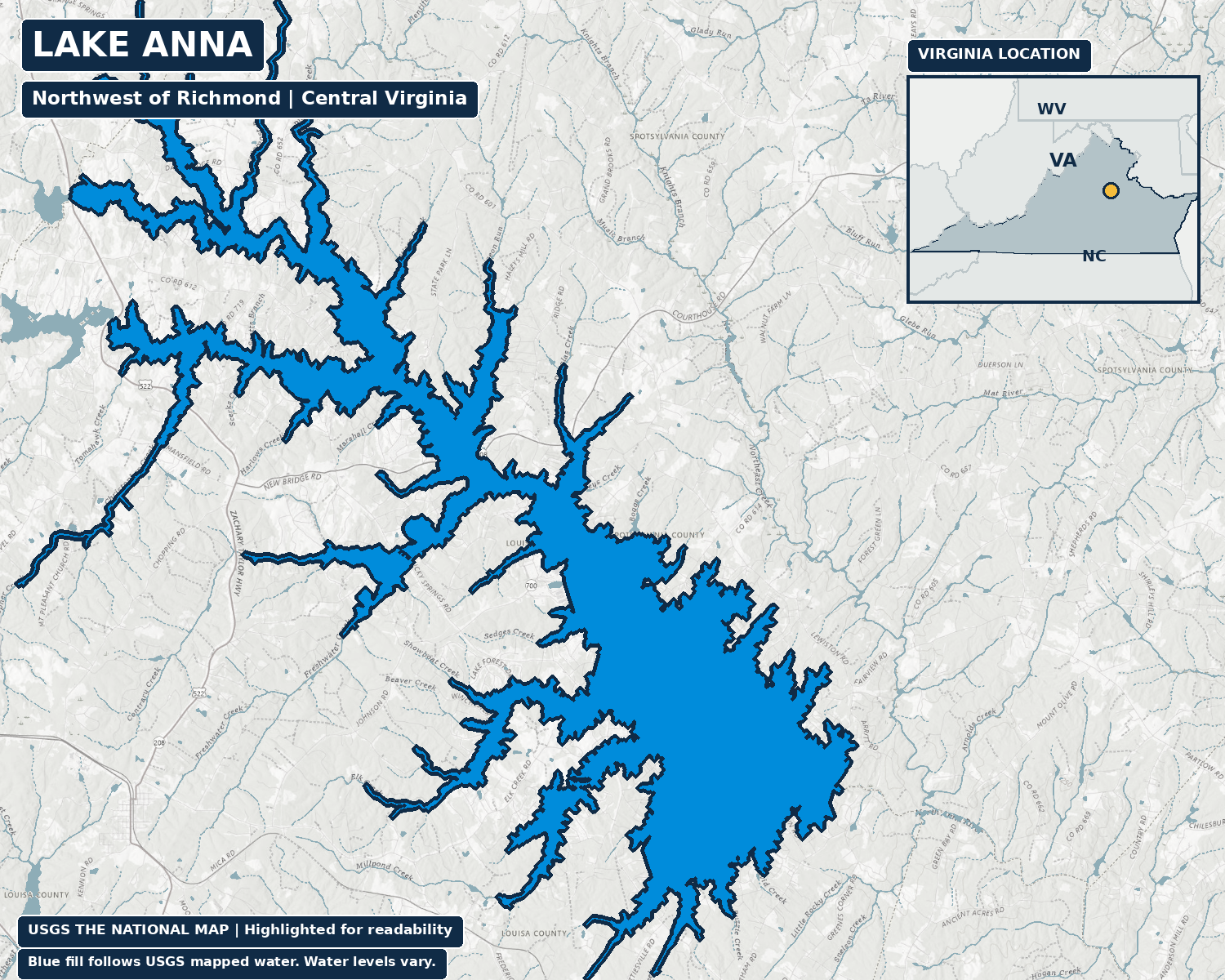
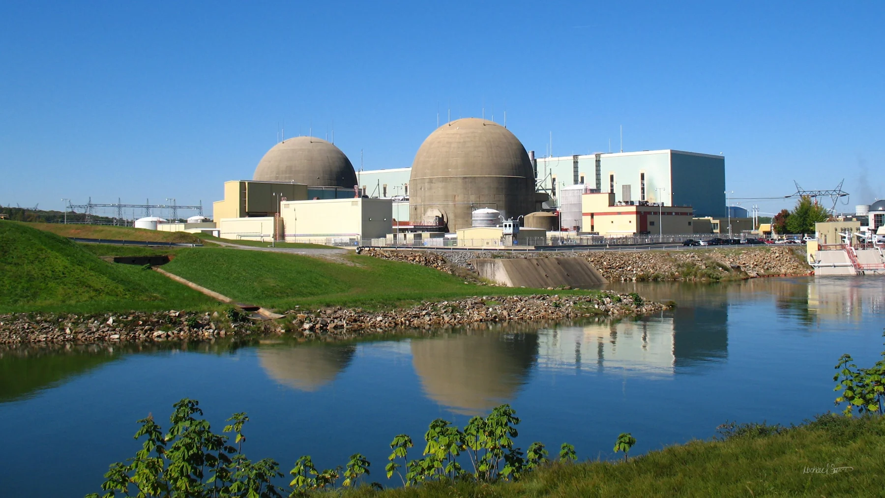
In the Louisa, Orange and Spotsylvania area northwest of Richmond, Lake Anna was formed by damming the North Anna River. Virginia Electric and Power Company, now Dominion Energy, built it to help cool North Anna Power Station. The operator dates closure of the dam gates to January 1972 and the reservoir reaching full height to December 1972.
That timeline contains a dramatic weather detail. Dominion says the lake was expected to take years to fill, but heavy rain from Hurricane Agnes in June 1972 accelerated the process. Dam closure, rapid filling after the storm and full level in December are distinct milestones.
The familiar public and private sides reflect the cooling system. The station takes water from the main lake and discharges warmed cooling water into the Waste Heat Treatment Facility, whose lagoons allow it to cool before returning. Dominion says this cooling water does not touch the nuclear fuel. Recreation grew around a lake whose original job remains part of its operation. Its warmer-water geography follows infrastructure, rather than two naturally different lakes.
Smith Mountain Lake
A power project can send water back uphill.
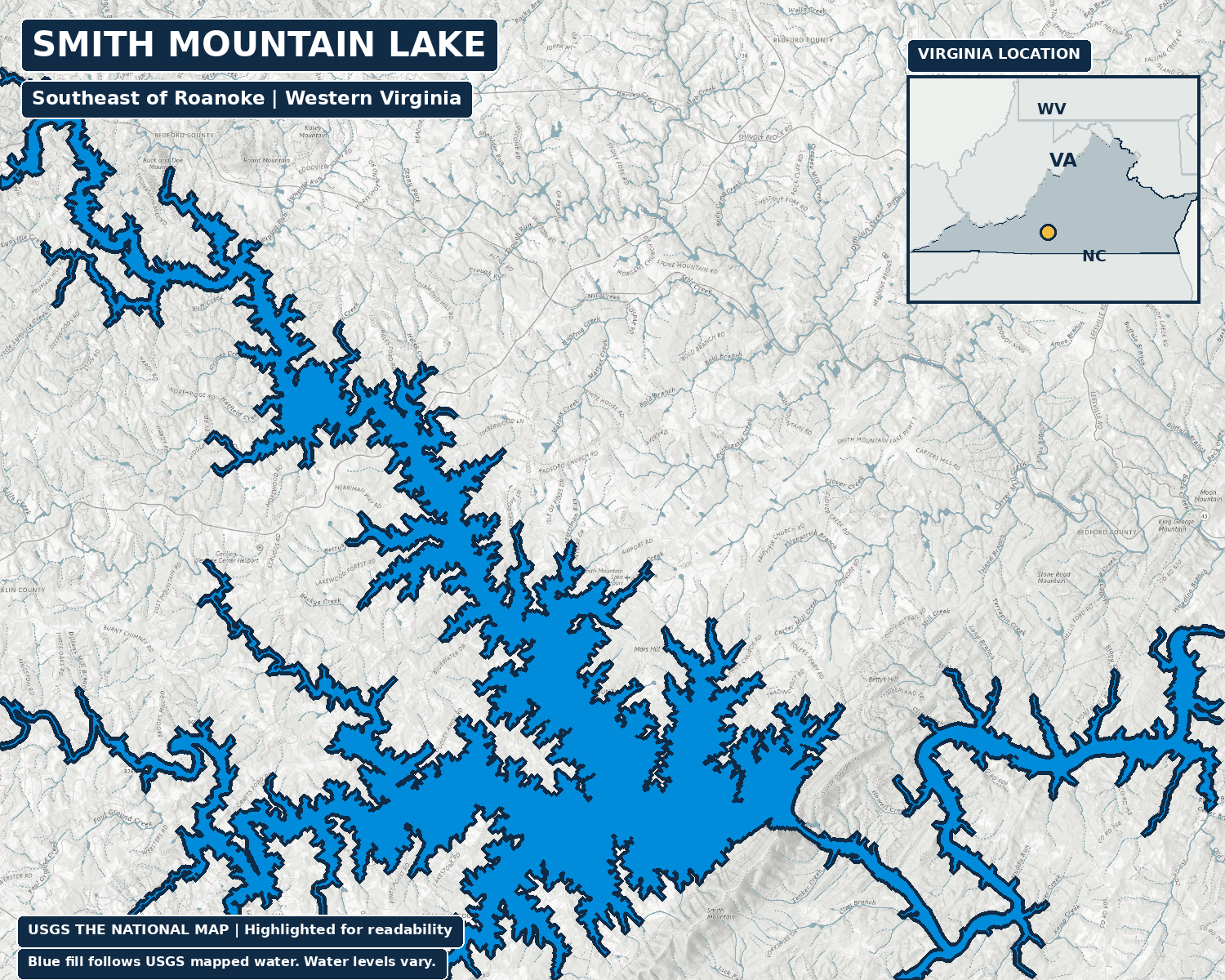
Smith Mountain Lake, southeast of Roanoke, was created as part of Appalachian Power’s project on the Roanoke River. The operator separates construction beginning in 1960, completion of the two dams in 1963 and the lakes reaching normal full water level in 1966. A completed dam did not mean an instantly full reservoir.
The especially interesting part is the relationship with Leesville Lake downstream. Water stored in Smith Mountain Lake passes through turbine generators and enters the lower lake. Some of that water can later be pumped back uphill for reuse. Pumped storage means spending electricity to lift water, then using that stored elevation to generate electricity when it is needed.
Appalachian Power describes generation typically occurring when demand is high and pumping when demand is low, with operation varying by demand. Seen from the shoreline, the lake is a broad recreational landscape. Seen as an operating system, it is also the upper half of a linked power project. Its origin explains why the water level is part of how the place works.
Why the origins matter
The view is only the visible part.
These histories turn familiar scenery into evidence of how a region grew. Barcroft stored drinking water before it anchored a neighborhood. Accotink supplied the Army before it became a park. Burke was built for fishing. Reston used lakes within a community plan. Anna and Smith Mountain tied large water landscapes to electricity.
None of that makes engineered lakes ecologically unimportant. Water, shorelines, wetlands and surrounding trees can become meaningful habitat and places for people to gather. Their continued value also involves maintenance, management and choices about the land draining into them. The original purpose and the present meaning can both matter.
The next time you pass a spillway, a waterfront plaza or a long arm of reservoir, look for the connection between the water and what surrounds it. Ask who holds it back, what flows into it and which parts of the shoreline people can actually use. A place that feels timeless may depend on a dam and decisions that still matter today.
Why this matters locally
Knowing why a lake exists helps explain the neighborhood, park or infrastructure around it. The water tells a story about what this region needed, and what people chose to build.
Which familiar lake will you look at differently now?
Sources and further reading
Where the reporting comes from.
This article draws on public records, official statements, and attributed local reporting. Each link opens the original source.
- Virginia Administrative Code: natural and constructed lakes (9VAC25-260-5) ↗
- Lake Barcroft Association: The Lake Barcroft Story ↗
- Fairfax County: 2016 Accotink history display boards (PDF page 10) ↗
- Fairfax County Park Authority: Accotink master-plan history ↗
- Fairfax County Public Works: Accotink history and August 25, 2026 study update ↗
- Fairfax County Public Library / Braddock Heritage: Burke Lake historical photograph record ↗
- Virginia DWR: Burke Lake ownership and fisheries management ↗
- Fairfax County Park Authority: FY2017 annual report, Burke opening photograph (printed page 15, PDF page 16) ↗
- Northern Virginia Regional Commission: Abbreviated History of the Occoquan Watershed (October 2023, PDF pages 1 and 2) ↗
- Reston Association: Lakes and Watersheds, including access and swimming rules ↗
- Reston Association: 2024 State of the Environment, lake impoundment table (printed page 18, PDF page 25) ↗
- Fairfax County: Lake Anne Village Center history and planning ↗
- Reston Association / Aquatic Environment Consultants: 2024 monitoring report, lake profiles (pages 22, 46, 69 and 92) ↗
- Fairfax County Park Authority: Lake Fairfax master-plan report (October 2001, printed page 7, PDF page 7) ↗
- U.S. Fish and Wildlife Service: 2022 Lake Drummond Wildlife Drive brochure (PDF page 1) ↗
- U.S. Fish and Wildlife Service: Great Dismal Swamp refuge history and conservation ↗
- Virginia Tech / Jon Cawley: A Re-Evaluation of Mountain Lake (1999) ↗
- Virginia Tech / Jeanne Marie Roningen: Hydrogeologic Controls on Lake Level (2011) ↗
- Virginia Tourism: Dirty Dancing and Mountain Lake Lodge ↗
- Dominion Energy: North Anna Power Station and Lake Anna history and cooling system ↗
- Appalachian Power: Smith Mountain Project history and pumped-storage operation ↗
- USGS: The National Map topographic basemap used for supplied lake maps ↗
- U.S. Census Bureau: TIGERweb state-boundary geography used in map insets ↗