The local story
At Skyline, picture small planes where the towers stand. Along Old Dominion Drive in McLean, picture an electric trolley following the road’s corridor. At Alexandria’s Torpedo Factory, picture manufacturing equipment where artists now work. Three familiar places make more sense when you know what came before them.
The interesting question is not simply how old a community is. It is what shaped the place, and what evidence you can still see. A rail line can explain a road. A planning decision can explain a skyline. A shopping center can tell a story about families rebuilding a community far from home.
This is a selected seven-community tour, not a complete inventory of Northern Virginia. Each stop has a different origin story, and none of these stories describes everyone who lives there. Start with the map, then look for the clues on your next drive or walk.
Get your bearings
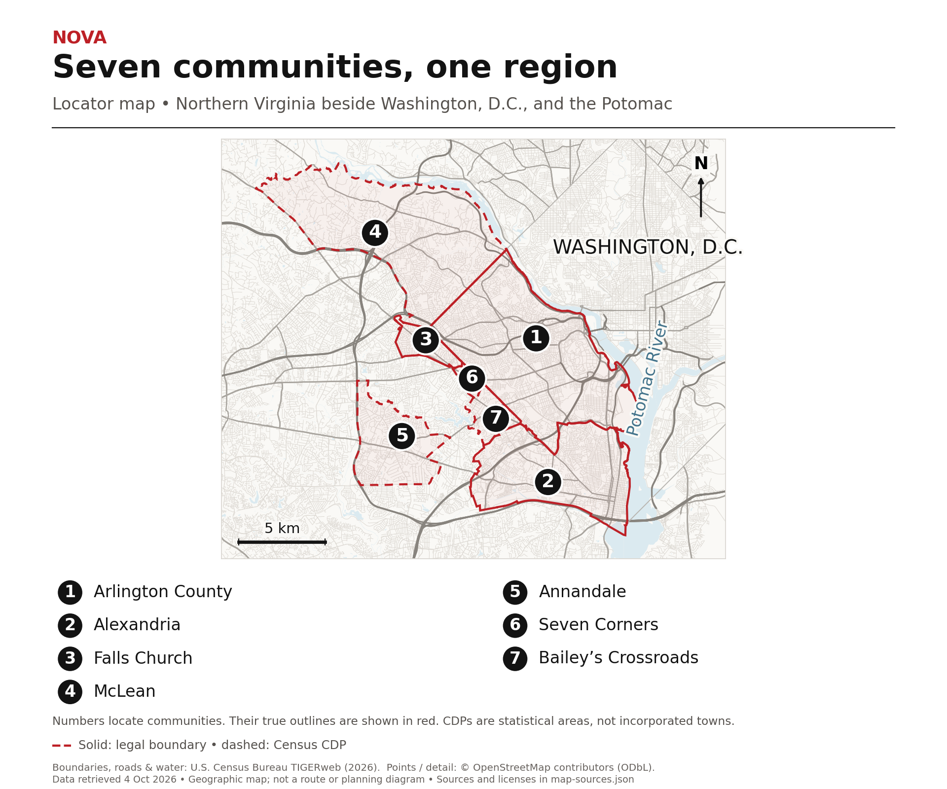
Seven names, several kinds of places.
Arlington is a county. Alexandria and Falls Church are independent cities, with their own governments separate from surrounding counties. McLean, Annandale, Seven Corners and Bailey’s Crossroads are unincorporated Fairfax County communities. Their Census-designated place boundaries help locate them statistically; those lines do not create city governments.
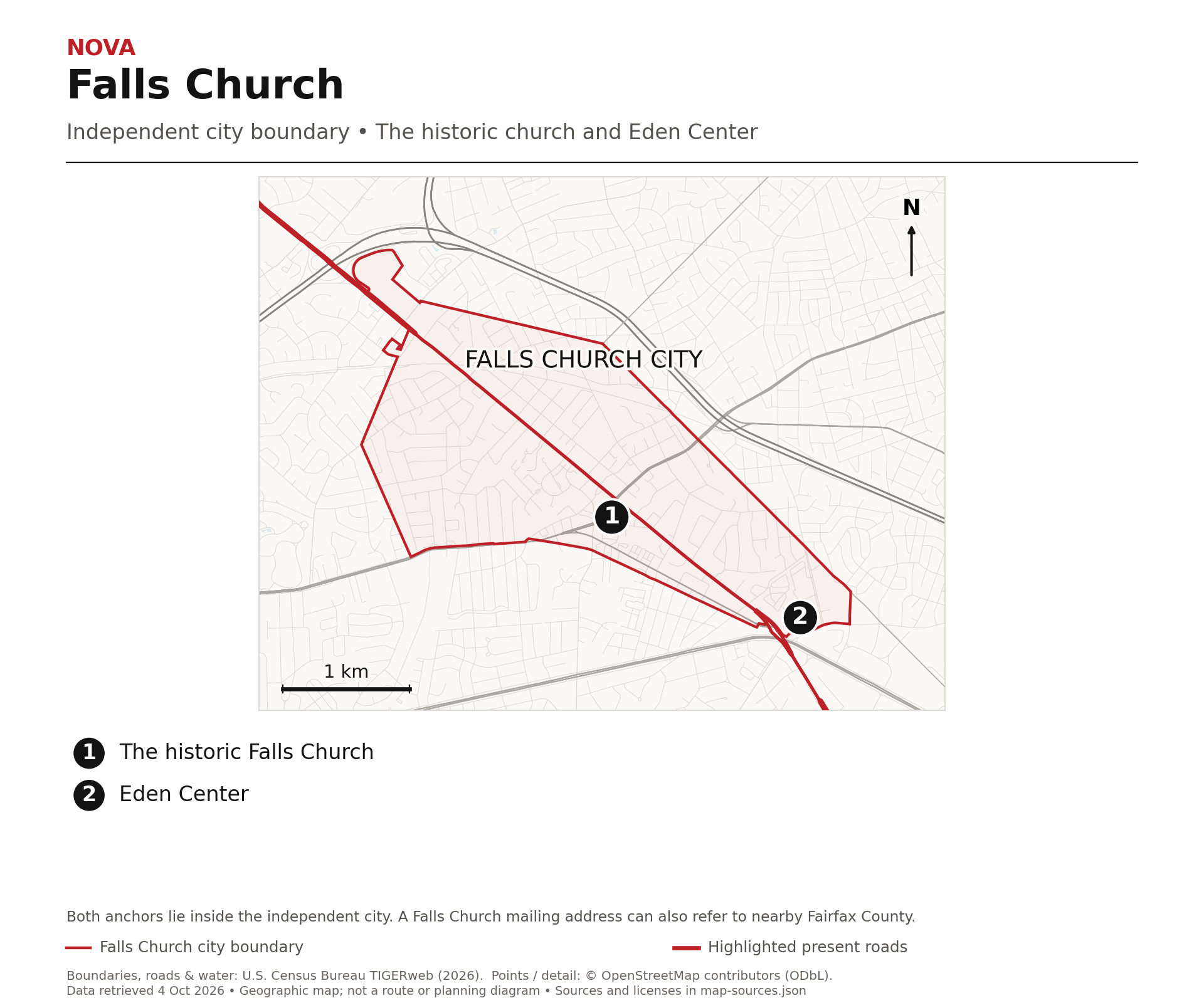
A mailing address, historic village, Census boundary and neighborhood understood by residents can cover different ground. A Falls Church postal address does not automatically put a property inside Falls Church City. The maps show the boundary type, rather than pretending all seven names represent the same kind of jurisdiction. Numbered markers identify the article’s landmarks, not property lines.
| Community | What helped shape it | A clue you can still see | Jurisdiction |
|---|---|---|---|
| Arlington | Metro and deliberate concentration of growth | Five station areas from Rosslyn to Ballston | Arlington County |
| Alexandria | Port commerce, freight rail and naval industry | Waterfront, Potomac Yard and Torpedo Factory | Independent city |
| Falls Church City | A namesake church and Vietnamese enterprise | 1769 brick church and Eden Center | Independent city |
| McLean | Electric railway and its station | Old Dominion Drive | Fairfax County; unincorporated |
| Annandale | Older crossroads and immigrant businesses | Little River Turnpike and its commercial core | Fairfax County; unincorporated |
| Seven Corners | Converging roads and suburban shopping | Route 7 and Route 50 junction | Fairfax County; unincorporated |
| Bailey’s Crossroads | Bailey family land and a later airport | Moray Lane and Skyline | Fairfax County; unincorporated |
Arlington
The skyline was a planning choice.
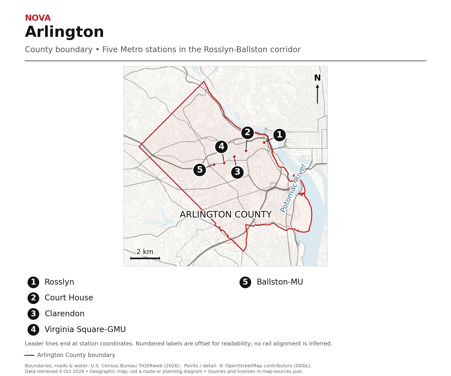
Arlington’s towers are more than the result of being close to Washington. The Rosslyn to Ballston corridor reflects a decision to put transit and substantial growth together. County officials pushed for an underground Metro route serving existing commercial areas, rather than treating the railway simply as a way to carry people through the county.
The five station areas are Rosslyn, Courthouse, Clarendon, Virginia Square and Ballston. They are the five stops in this corridor, not the whole Arlington Metro system. Along Wilson and Clarendon boulevards, the contrast between taller buildings near stations and nearby residential streets gives the plan a visible shape.
Look for the change in scale
The planning idea concentrated more intense development close to station entrances, then stepped it down toward surrounding neighborhoods. Maryland’s Department of Planning describes the corridor’s station plans and land-use decisions as an example of connecting transit with growth. The useful clue is the transition: a cluster of offices, apartments and shops, then a different scale of streets and homes. The map connects the actual station locations; it is not a zoning map or a promise that every nearby block follows one identical pattern.
The county used to be inside the capital
Today’s Arlington was once part of the District of Columbia’s Virginia-side territory. Congress authorized retrocession in 1846; Virginia formally accepted the territory in March 1847. Those are separate events, which explains why both years appear in local histories. The Pentagon and Arlington National Cemetery give the county a national identity, but neither alone explains the everyday pattern along this corridor. For that, follow the stations and the decisions about what should grow around them.
Alexandria
A port, a freight yard and a weapons factory.
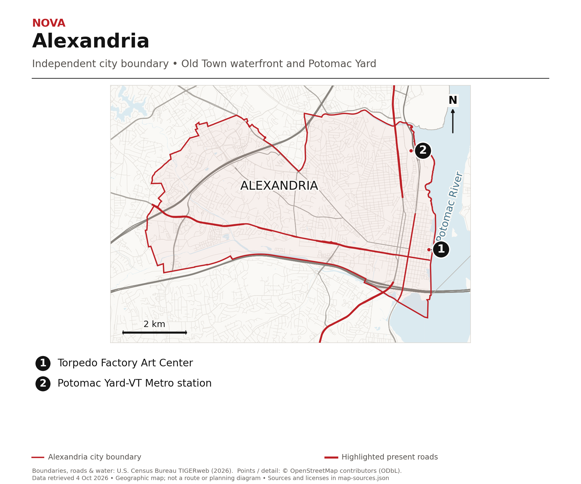
Alexandria’s waterfront began as working infrastructure. The town founded in 1749 grew around trade: tobacco moving toward the Potomac, merchants connecting inland producers with ships, and streets linking the river to warehouses and businesses. The shoreline was not simply an attractive backdrop. It was a reason for the town to be there.
That history also includes enslaved labor and Alexandria’s role in the domestic slave trade. A picturesque waterfront is only part of the story. The city’s historical and archaeological accounts are useful because they explain the commercial systems, and the people affected by them, behind the preserved buildings.
Potomac Yard sorted the region’s freight
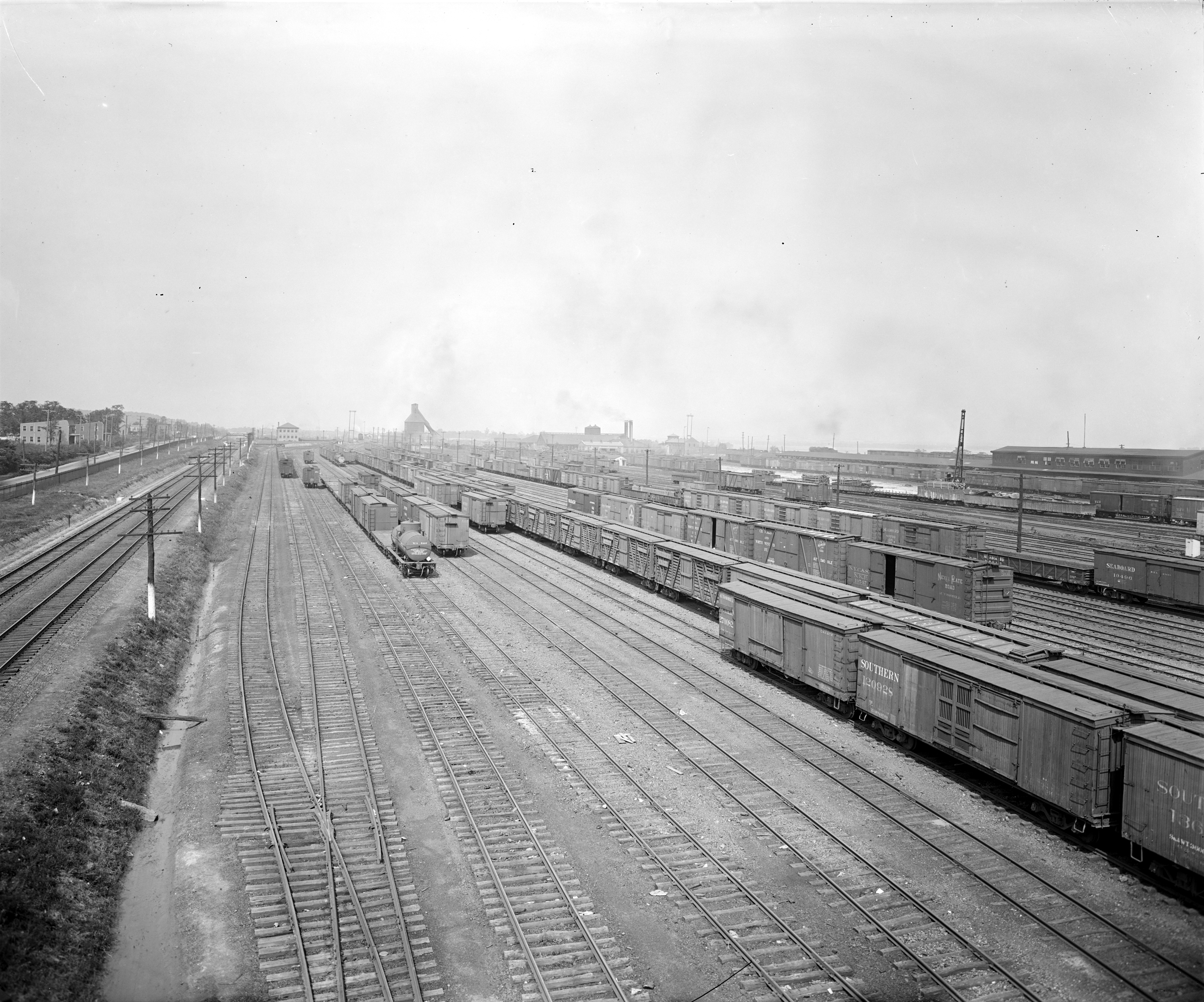
Potomac Yard opened in 1906, according to the city’s detailed archaeology and heritage records. A classification yard is a place where freight cars are separated and regrouped into trains headed toward different destinations. Here, multiple railroads could exchange and sort traffic between north and south. The broad landscape of tracks was a machine for moving goods. The detailed records are stronger evidence for 1906 than the city’s general timeline, which lists 1907. Today’s Potomac Yard neighborhood carries the name of that earlier transportation landscape.
An industrial shell found a different purpose
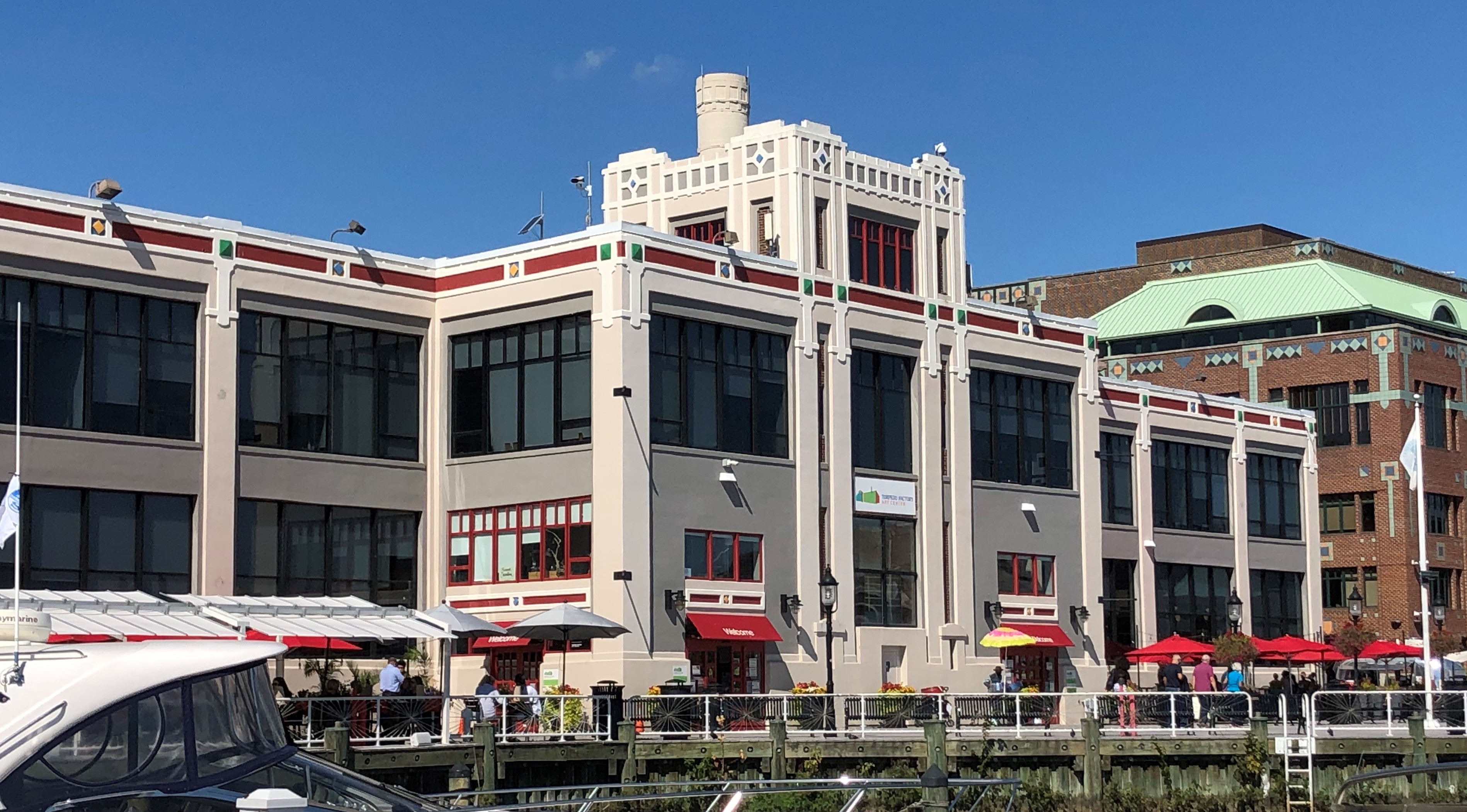
Construction of the Torpedo Factory began on November 12, 1918, the day after the First World War armistice. That construction date is not a claim that it was already producing weapons during that war. The city’s timeline dates the station’s opening to 1919; its detailed history records the first completed torpedo in November 1920. Opening a plant and finishing its first weapon were different milestones. Manufacturing, storage and later wartime production followed. In 1974 the building became an art center. Its substantial industrial exterior is the clue that survives. A working waterfront, a freight yard and a factory all became settings for different kinds of urban life.
Falls Church City
An old church and a newer cultural landmark.
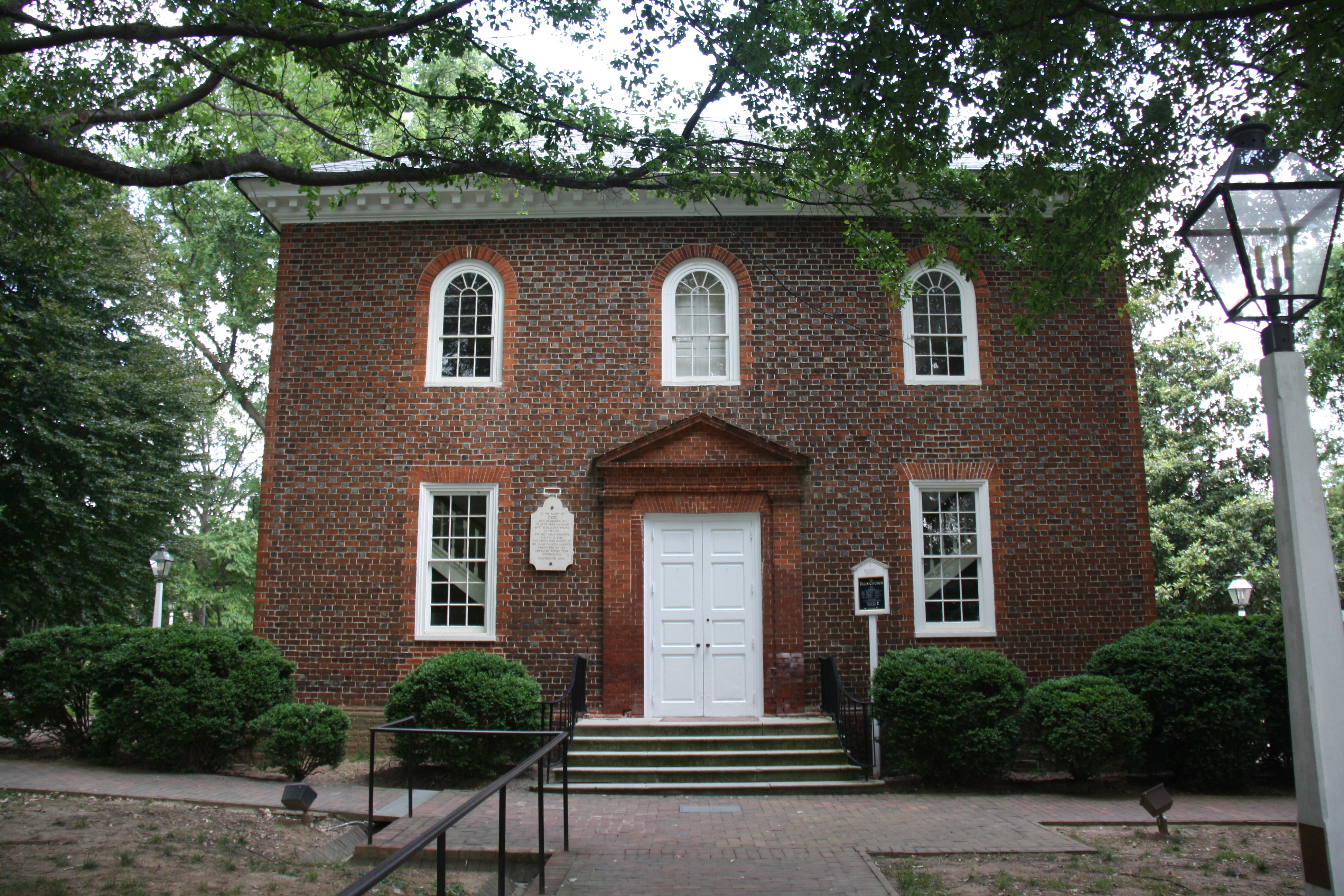
The Falls Church gives the community its name, but the building and the congregation do not have the same birthday. An earlier wooden church was completed in 1734. The surviving brick church was begun in 1767 and completed in 1769. Calling the present building a 1734 church would collapse two different chapters of its history.
At the historic church, look at the brick building as a surviving connection to the older settlement. Then follow the city east toward Eden Center. These landmarks represent different eras and communities, but both explain why Falls Church has an identity much larger than a line on an envelope.
Eden Center is more than a food destination
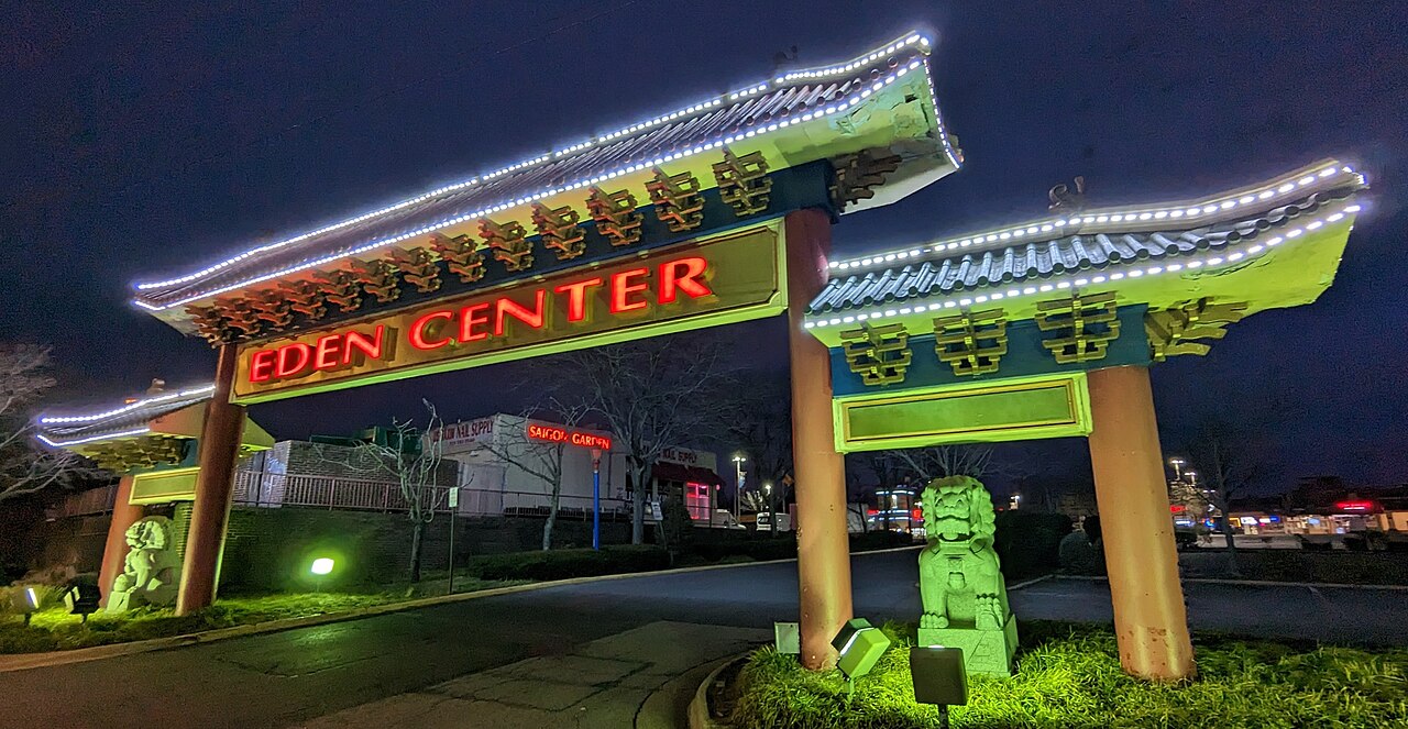
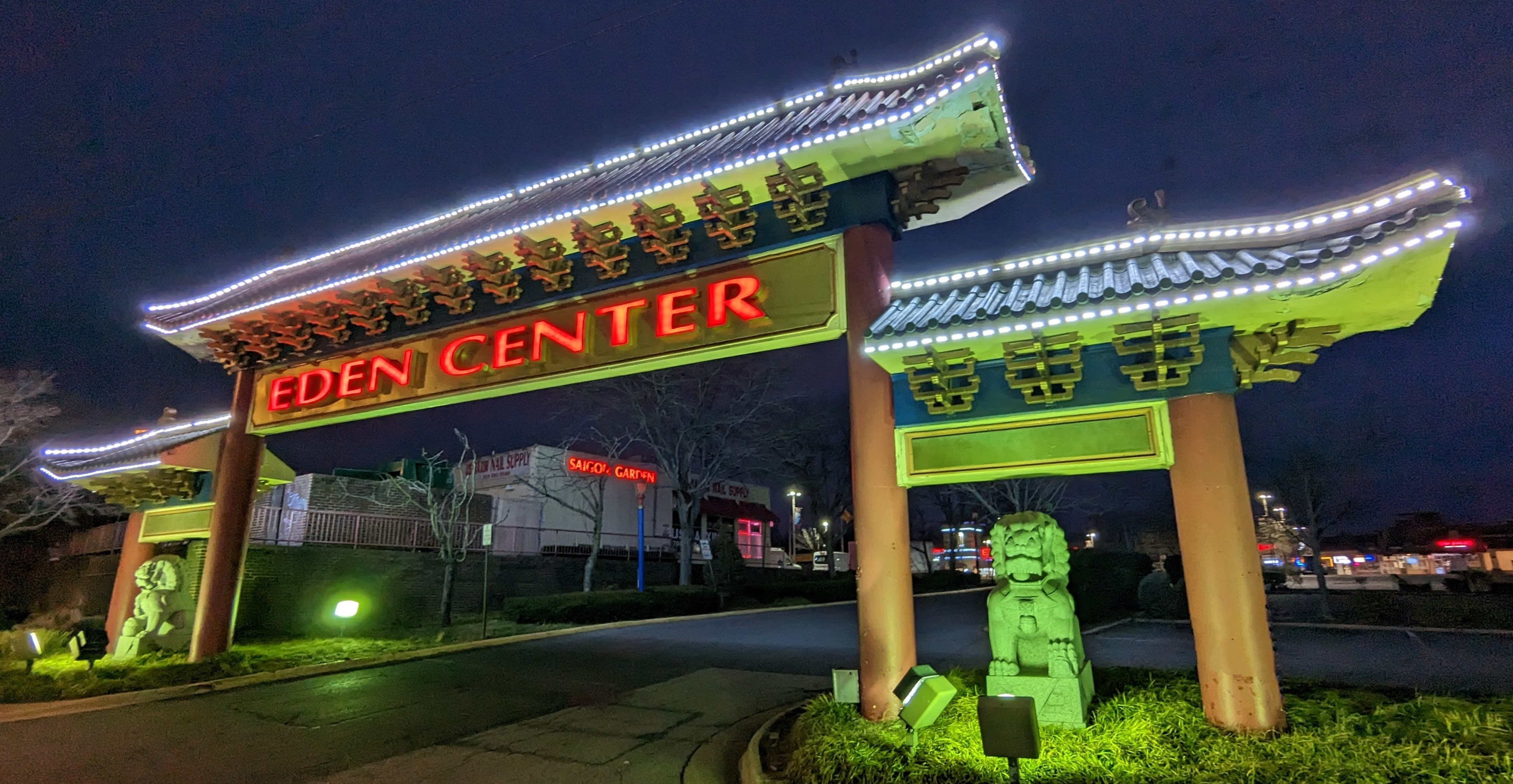
Eden Center dates its Vietnamese business community to 1984. The City’s East End history traces the movement of Vietnamese merchants from Clarendon, where a commercial community known as Little Saigon had developed after the Vietnam War. Rising land values and redevelopment helped shift some businesses to the former Plaza Seven shopping center. Restaurants are the most immediately recognizable draw, but the center also brings together groceries, shops and services. Its role is about livelihoods, language and community continuity as well as what is on a menu.
Read the boundary as carefully as the sign
Eden Center is inside Falls Church City, near the complicated meeting of the City, Arlington and Fairfax County. Seven Corners Shopping Center nearby is in Fairfax County. The City’s own East End plan makes that distinction explicit. It is a good example of why familiar regional names can confuse people. A place can be connected to the Seven Corners area without being inside the Fairfax Census community, and a business can use a Falls Church address without settling the jurisdictional question.
McLean
You can drive an old trolley corridor.
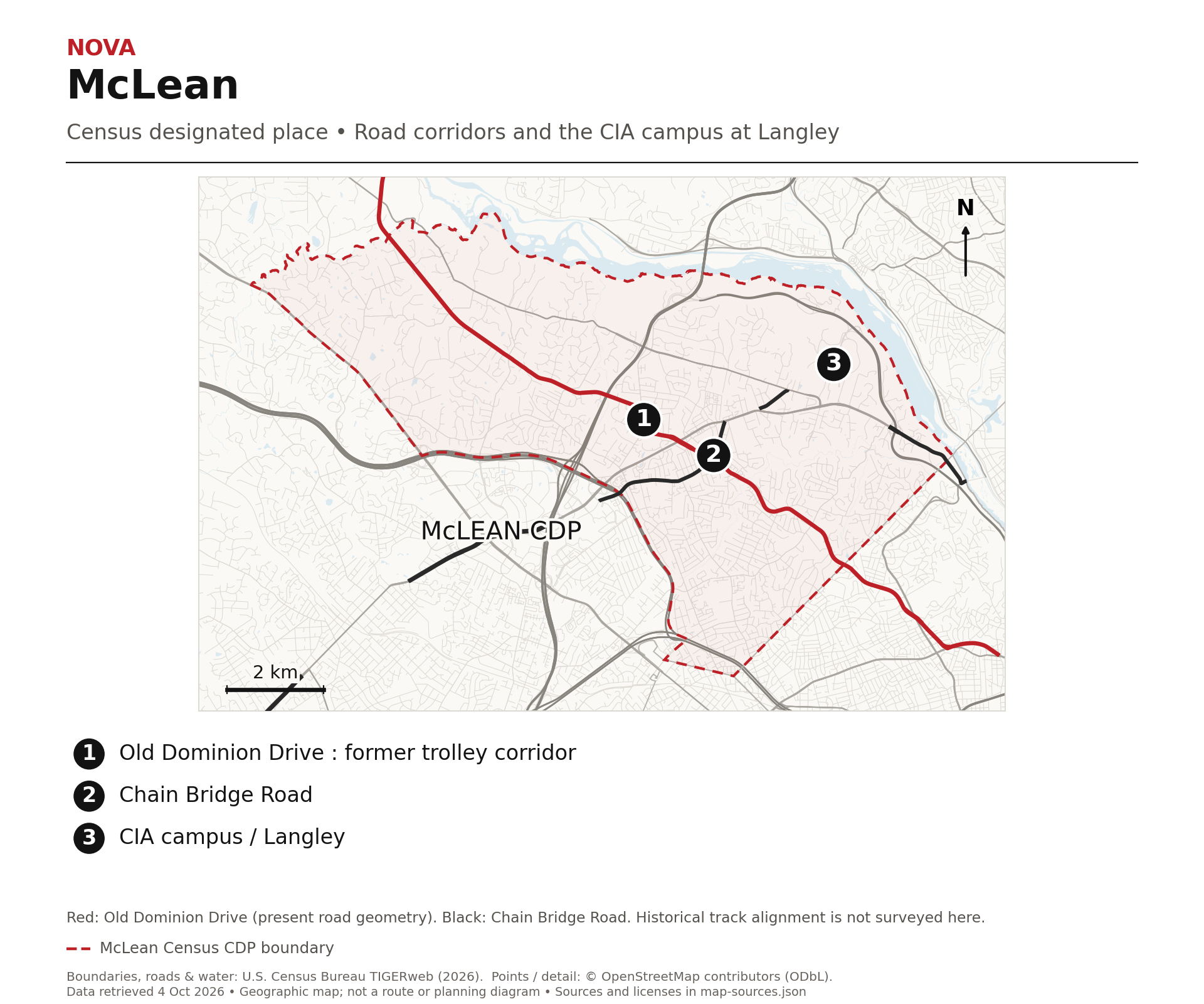
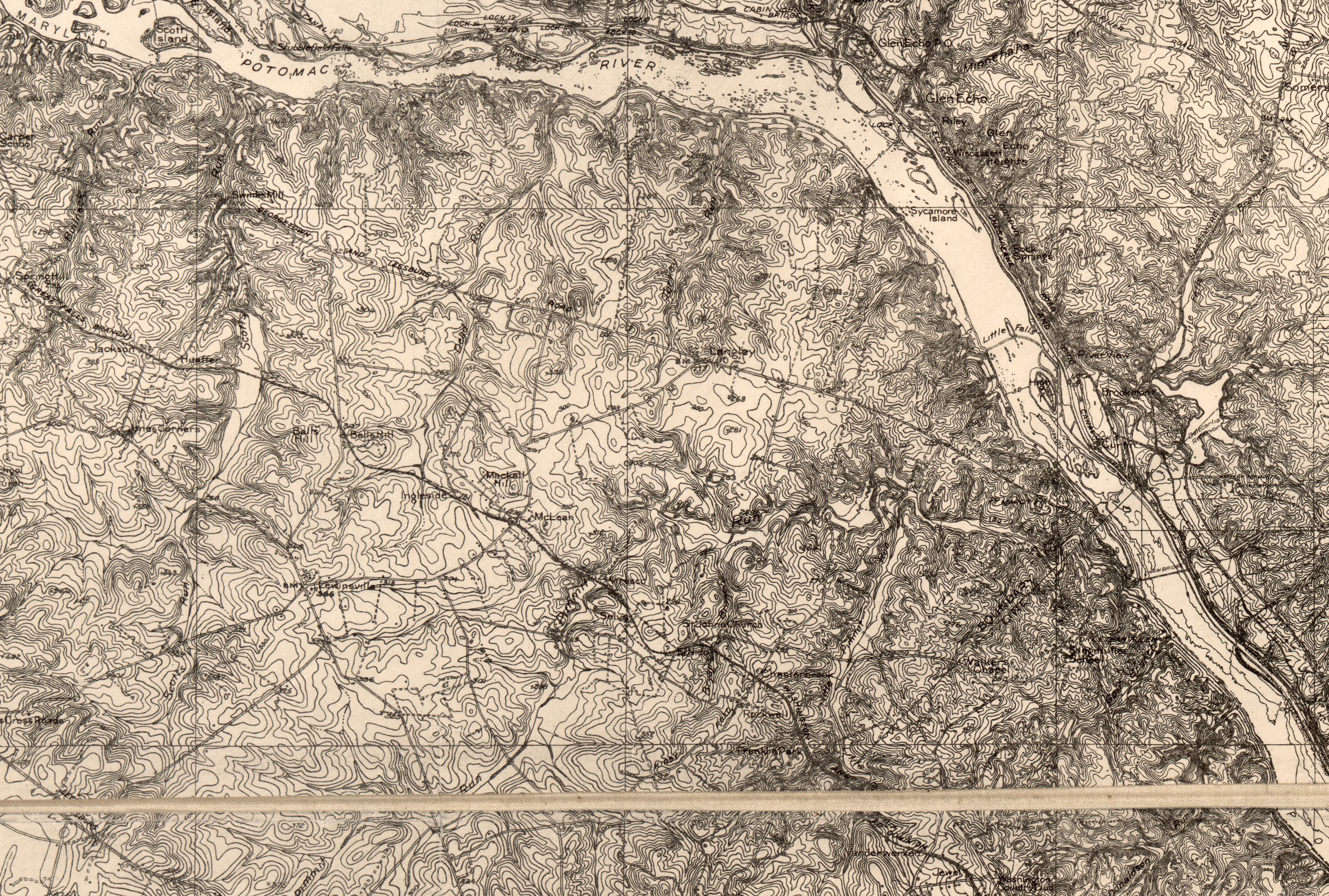
Old Dominion Drive carries a piece of McLean’s rail history in its alignment. Fairfax County’s historical marker records an electric Great Falls and Old Dominion line opening in 1906, crossing Chain Bridge Road between Langley and Lewinsville. A station helped bring activity to a location between those older settlements.
The place took the name McLean in 1910, after John R. McLean, a railroad owner and publisher of The Washington Post. The county marker places the old station story around Old Dominion Drive, Chain Bridge Road and Elm Street. This was a transportation stop that became a community reference point.
The rail bed became a road
Train service ended in 1934. The county identifies the former rail bed with today’s Old Dominion Drive. That is the memorable part: the transportation mode changed, while a corridor remained useful. The contemporary map highlights present road geometry, not a surveyed reconstruction of every historical track. The archival USGS detail shows the electric railway in its own time. This Great Falls route should not be confused with the present Washington and Old Dominion Trail, which follows a different former railway corridor.
Langley remained on the map
The CIA’s headquarters is associated with Langley, an older place name within the broader McLean area. The agency’s own history explains that Langley was the name used for the site during headquarters planning, and it persisted. The old Langley and Lewinsville post offices were replaced by a McLean post office in 1910. The result is a useful local distinction: McLean can describe the broader community while Langley identifies an older locality. One name did not erase all the others when the trolley station gained prominence.
Annandale
An older crossroads became a regional food destination.
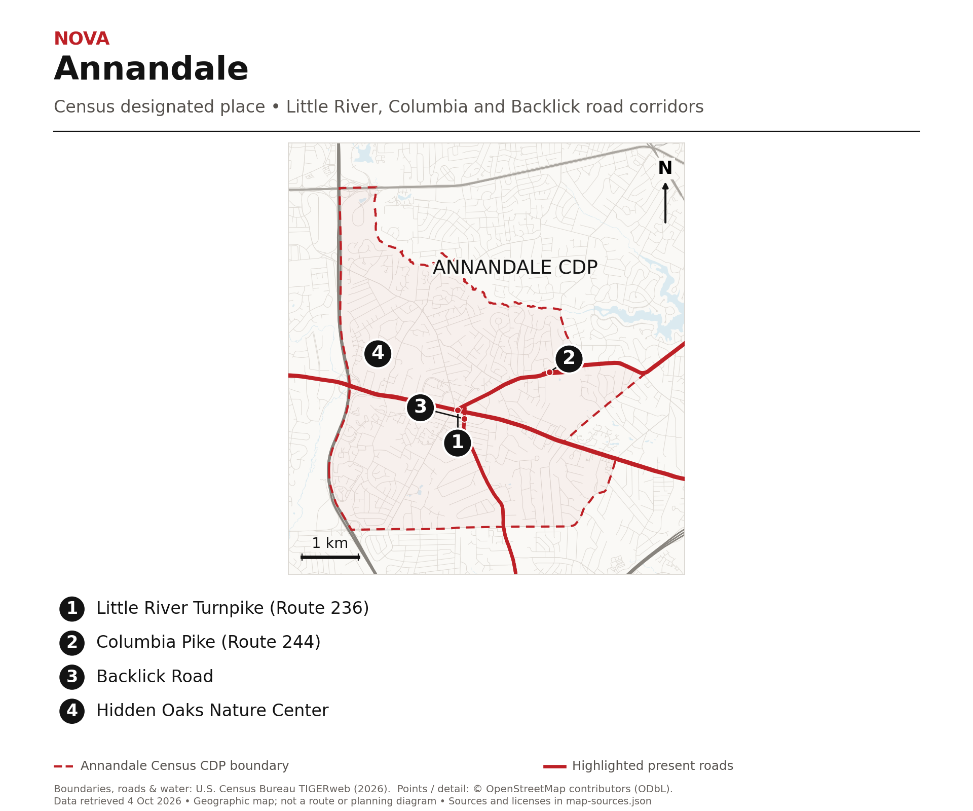
Annandale’s commercial core grew around roads before it became known for restaurants. Little River Turnpike, Columbia Pike and Backlick Road connected the older settlement with a wider region. The county’s historical development study describes early businesses at those crossroads, then the growth of shops as surrounding farms became residential neighborhoods after the Second World War.
That sequence helps explain the landscape. The roads were already gathering places for trade and services. Later business owners adapted that commercial setting to serve new customers and communities. The story is a succession of uses around a connected crossroads, rather than a restaurant district appearing on an empty map.
The food tells a community story
Visit Fairfax calls Annandale the capital region’s unofficial Koreatown. The county’s cultural-center study documents Korean grocers, restaurants, entertainment and other businesses as part of the area’s commercial transformation. Those are businesses serving everyday life as well as visitors looking for dinner. The label describes a recognizable cultural and commercial concentration. It does not mean every Annandale resident is Korean, or that Korean food accounts for all of the community’s identity. The broader mix of residents and businesses remains part of the place.
The woods are part of Annandale too
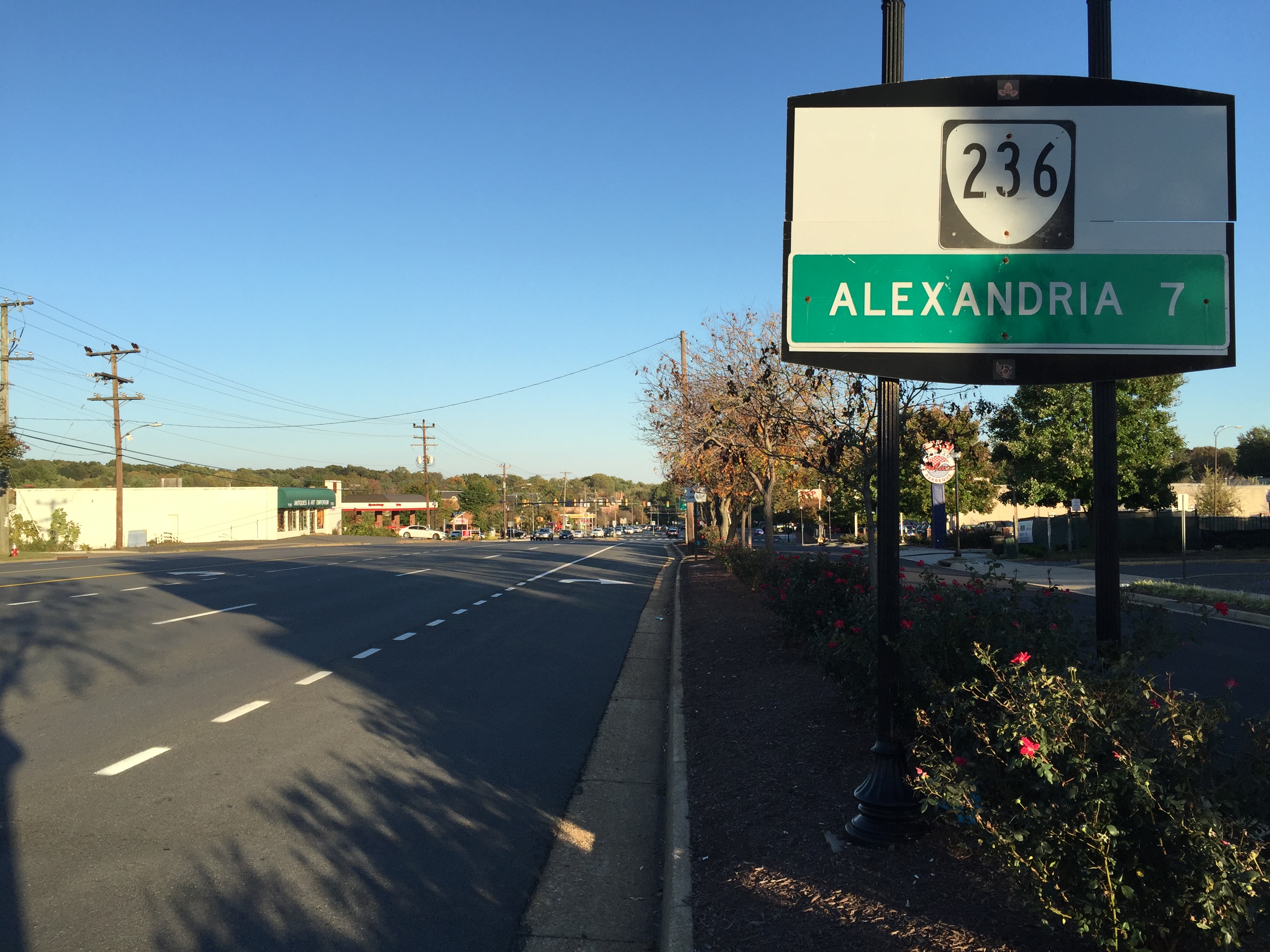
Hidden Oaks Nature Center sits within the 52-acre Annandale District Park. The acreage belongs to the park, not the nature-center building. Its trails, wooded setting and nature activities offer another way to read a community often described through its busiest roads. Use the map to connect the commercial crossroads with the park at Royce Street. The streetscape photograph is dated 2016, so it documents the road setting at that time rather than claiming to show today’s tenants or traffic conditions.
Seven Corners
The name is written into the roads.
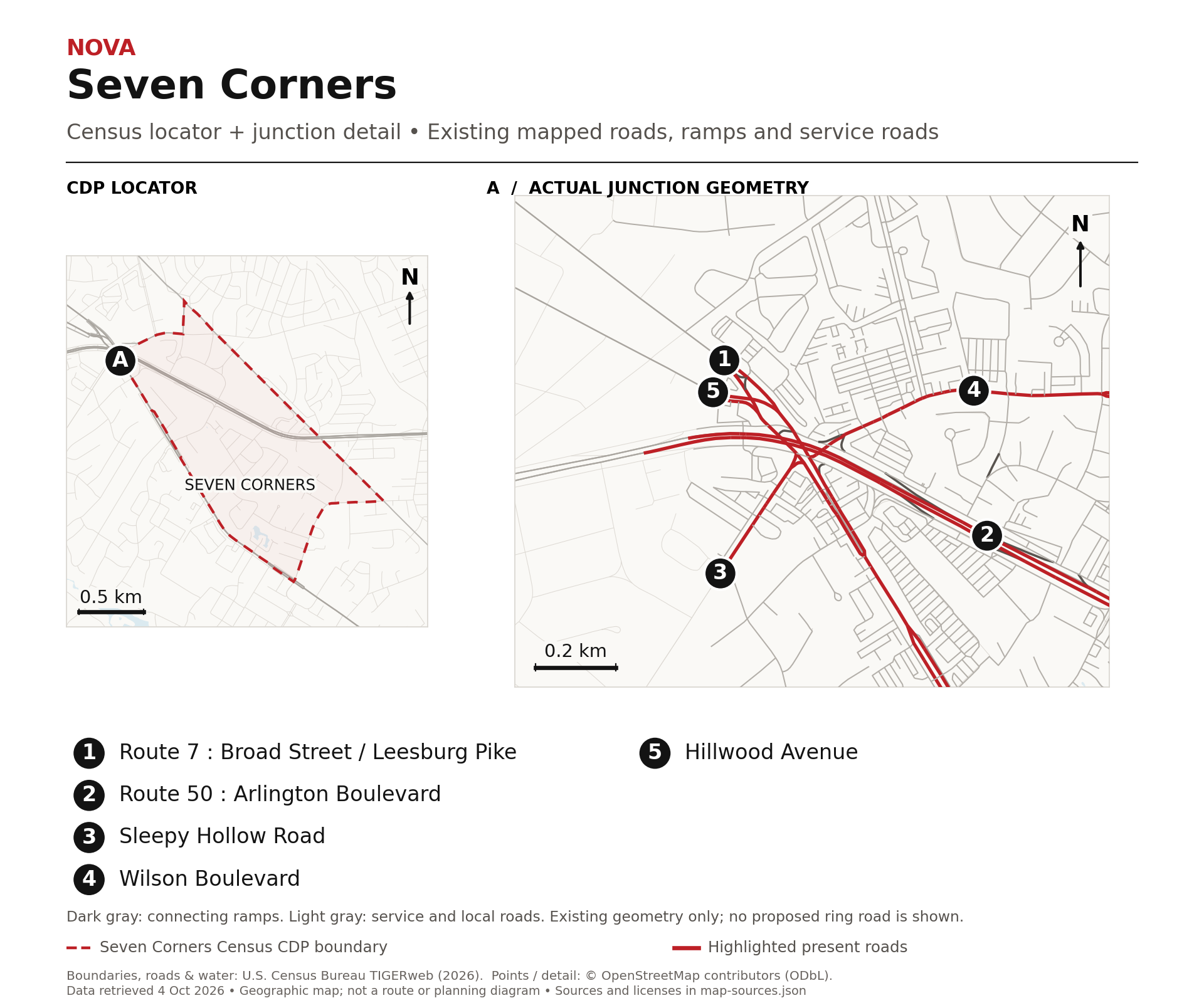
Seven Corners sounds like a count of seven separate streets. The more useful explanation is the geometry of a junction. The City’s regional history describes five roads converging to create seven corners: Route 7, Route 50, Wilson Boulevard, Sleepy Hollow Road and Hillwood Avenue. Connections and approaches make the intersection more complicated than a simple crossroads.
Route 7 is Leesburg Pike here, with East Broad Street on the city side; Route 50 is Arlington Boulevard. The local map and close view show actual roads rather than an invented diagram of seven spokes. Underpasses, connecting streets and shifted approaches are part of what makes the name easier to understand on a map than from behind a steering wheel.
Shopping followed the automobile
Seven Corners Shopping Center opened in 1956. Its regional scale and parking-oriented setting belong to the period when shopping increasingly followed suburban households and their cars. The center is in Fairfax County, next to the City’s East End. Read the surface parking, the large road approaches and the retail sites together: this is a landscape organized around access by car. That observation explains the setting without assuming that every building visible now dates to the original opening or that the tenant list has remained unchanged.
The junction still shapes the conversation
Fairfax County’s transportation work considers how people can move through this constrained network more clearly, including connections for walking and bicycling. Planning drawings describe proposed changes; they are not photographs of roads already built. The accompanying map is deliberately contemporary geography, not a rendering of the future ring-road concept. Seven Corners is an unincorporated Fairfax community, although nearby City and Arlington land make the broader area a meeting point of jurisdictions. A Falls Church mailing address does not change that distinction.
Bailey’s Crossroads
An airport arrived long after the name.
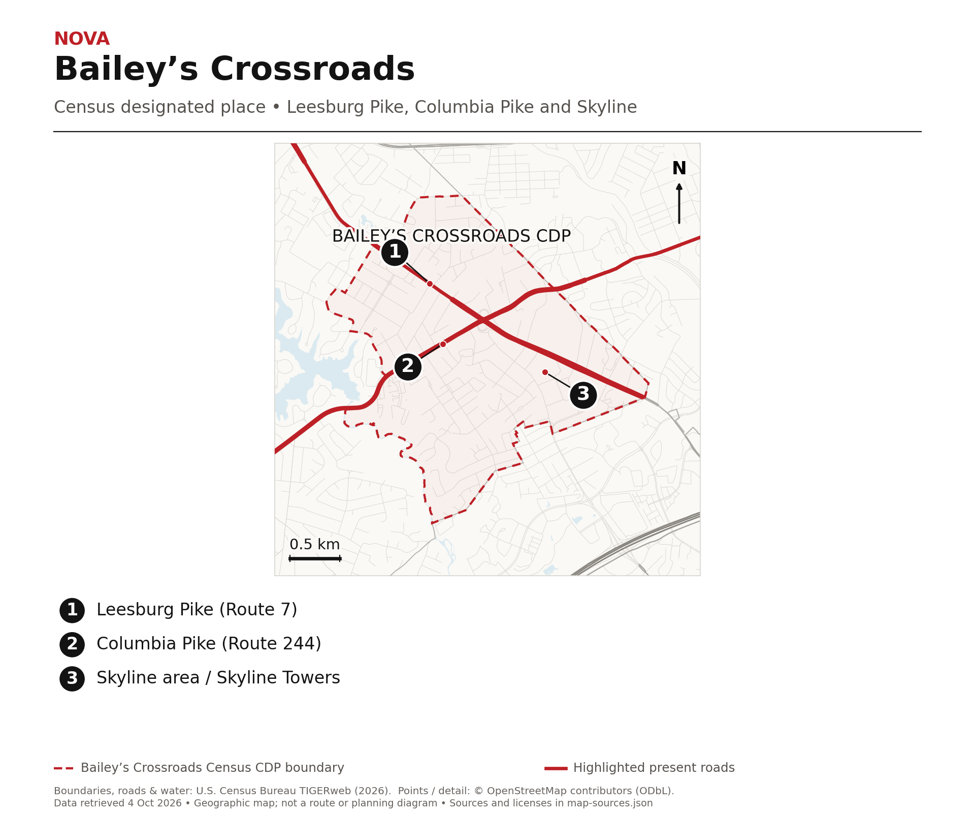
Bailey’s Crossroads takes its name from the Bailey family associated with land near Leesburg and Columbia pikes. Fairfax County’s marker records Hachaliah Bailey buying property here in 1837. His earlier traveling menagerie included an elephant. This is Hachaliah Bailey’s story; it should not be casually substituted with the later Barnum and Bailey circus partnership.
The house called Moray is gone, but Moray Lane preserves a small naming clue. The crossroads already had a history before airplanes arrived. Keeping those periods separate matters: the airport explains a later use of part of the landscape, not why the entire community was founded or named.
Picture an airfield beneath Skyline
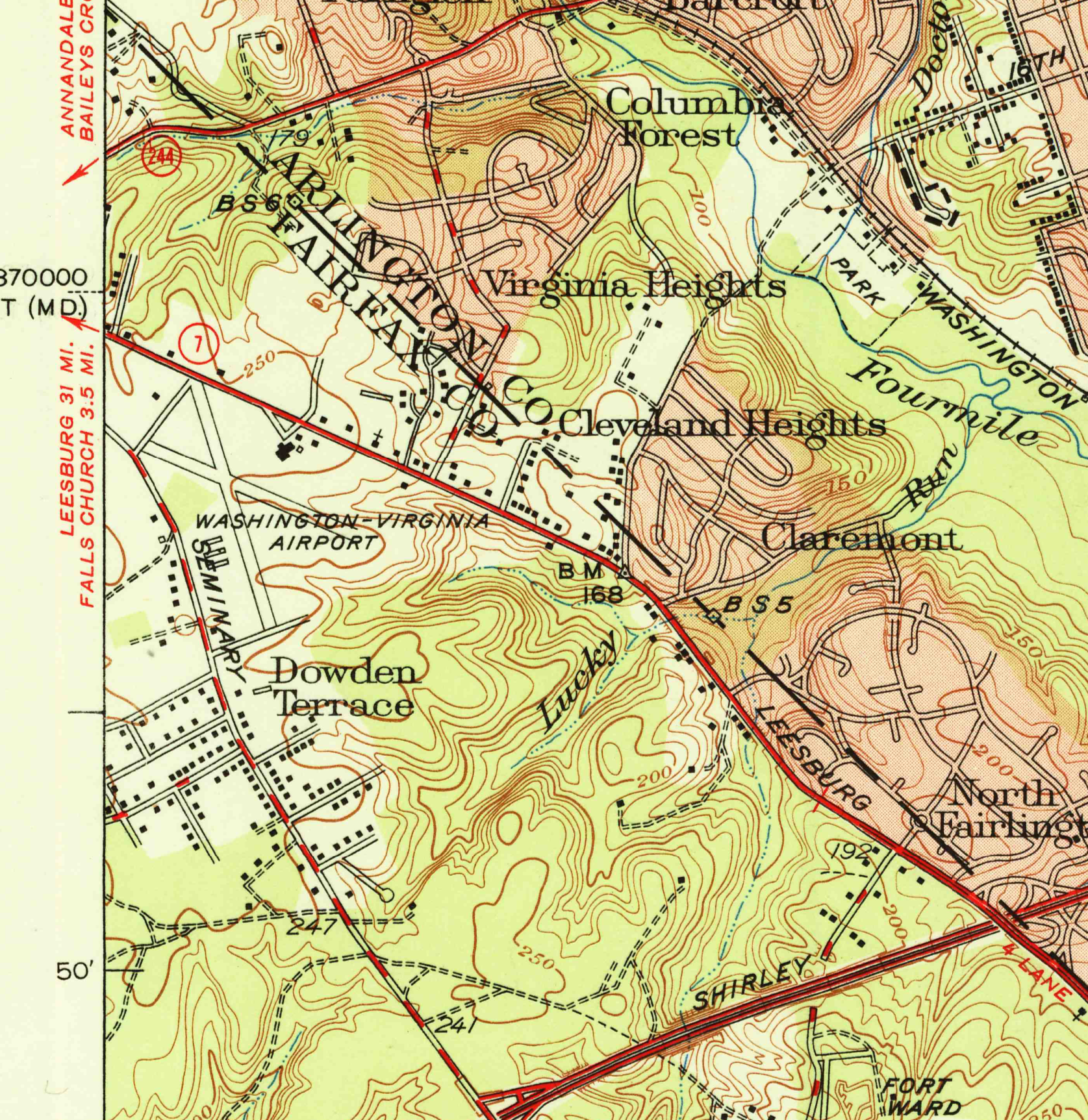
The county’s historical comprehensive plan places the Washington and Virginia Airport on the later Skyline site, operating from the late 1940s into the 1970s. The Circuit Court’s more detailed historical newsletter traces a smaller airport on leased land to 1941, the airport company’s incorporation to 1947, and closure to 1970. A 1951 USGS map labels the airfield beside Leesburg Pike and Seminary Road. This was general aviation, serving smaller aircraft, rather than another version of Washington’s major passenger airport. The printed historical map is evidence of the former use; Skyline does not yet appear on it.
From horizontal space to vertical buildings
An airfield needs broad open ground. Skyline put a much taller, more concentrated form of development on that landscape. The county describes the complex as an early high-rise mixed-use development that influenced redevelopment along Leesburg Pike. The most useful comparison is therefore spatial: the airport’s low, open field and the later towers. The archival detail reaches its western sheet boundary, so it does not show a complete measurable runway layout. No missing runway has been drawn in. Next time the Skyline buildings come into view, remember the smaller aircraft that once used this ground.
Why this matters locally
These places grew through different decisions about movement, work and community. The clues survive in a station cluster, a reused factory, a road alignment, a church, a shopping center and a name. Knowing the earlier purpose makes the familiar landscape easier to read.
What’s one thing about your community that more people should know?
Sources and further reading
Where the reporting comes from.
This article draws on public records, official statements, and attributed local reporting. Each link opens the original source.
- Arlington County: Rosslyn-Ballston corridor planning ↗
- Maryland Department of Planning: Arlington’s station-area planning ↗
- Alexandria: Discovering the Decades, 1846 and 1847 retrocession ↗
- Alexandria: A Brief History, port origins and commerce ↗
- Alexandria archaeology: Potomac Yard history and heritage trail ↗
- Torpedo Factory Art Center: manufacturing and 1974 reuse ↗
- The Falls Church: wooden church and surviving 1769 building ↗
- Eden Center: community history since 1984 ↗
- Falls Church City: East End history, PDF pages 4, 9 and 10 ↗
- Fairfax County: McLean and Bailey’s Crossroads historical markers ↗
- CIA: Why the headquarters is associated with Langley ↗
- Fairfax County: Annandale Cultural Center study, history on PDF pages 53 and 54 ↗
- U.S. Census Bureau: TIGERweb geographic boundaries ↗
- OpenStreetMap: geographic data and reuse license ↗
- Visit Fairfax: Annandale’s unofficial Koreatown ↗
- Fairfax County Park Authority: Hidden Oaks and Annandale District Park ↗
- Fairfax County Transportation: Seven Corners study ↗
- Fairfax County: 2007 Baileys plan, airport history on PDF pages 15 and 16 ↗
- Fairfax Circuit Court: airport and Skyline history, October 2018 newsletter ↗
- USGS: Alexandria 1951 historical topographic map ↗
- Library of Congress: circa-1915 USGS Washington and vicinity map ↗
- Alexandria: historical timeline, naval station opening in 1919 ↗
- Office of Historic Alexandria: first torpedo in November 1920, PDF page 1 ↗