The local story
The towers at Skyline are hard to miss. What’s harder to picture is the airport that occupied this land before them. People learned to fly here, kept their own airplanes here and hired small aircraft for trips. This was Washington-Virginia Airport, a working neighborhood airfield on the south side of Leesburg Pike.
Its story is about more than a surprising old photograph. It connects postwar flying, a family business and a growing suburb that eventually became too valuable to remain an open airfield. The maps and photographs below let you follow that transformation without having to imagine where the runways went.
Find the field
Start with the Skyline you already know.
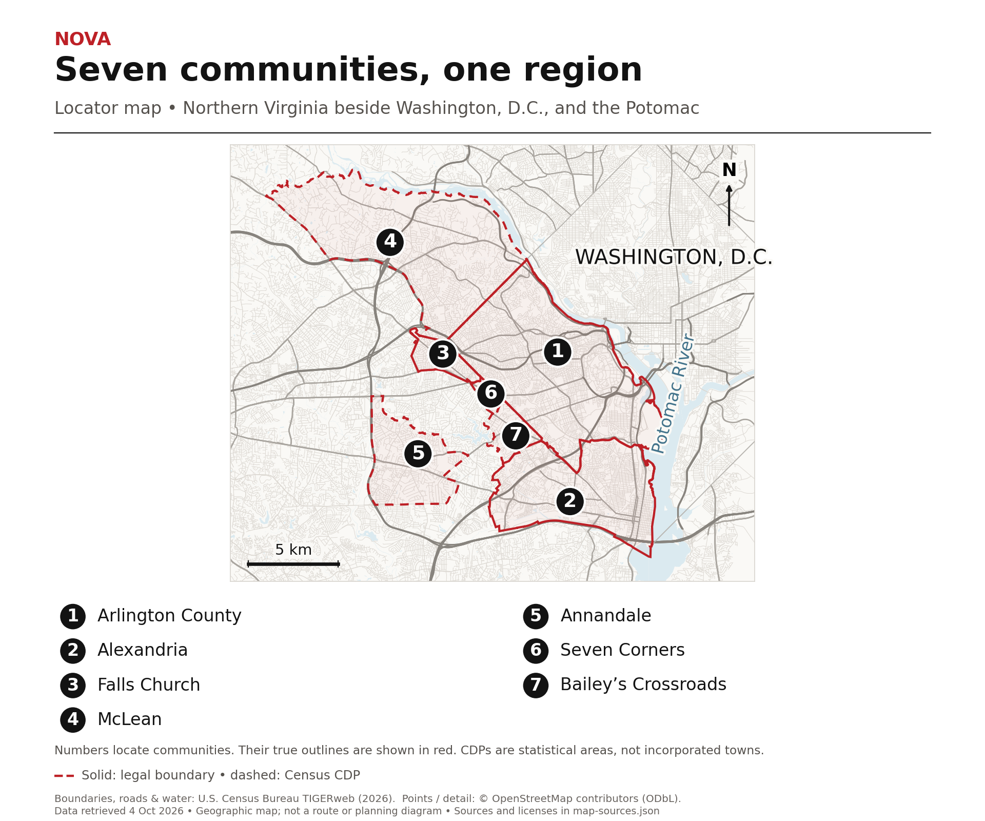
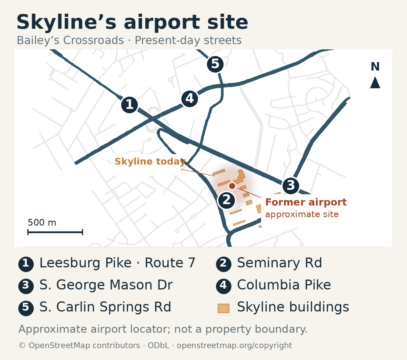
Look south of Route 7, also called Leesburg Pike, toward Skyline’s residential and office towers. Seminary Road and South George Mason Drive help orient the present-day site. The locator marks the general airport location, not a surveyed boundary or a promise that every modern building sits on a former runway.
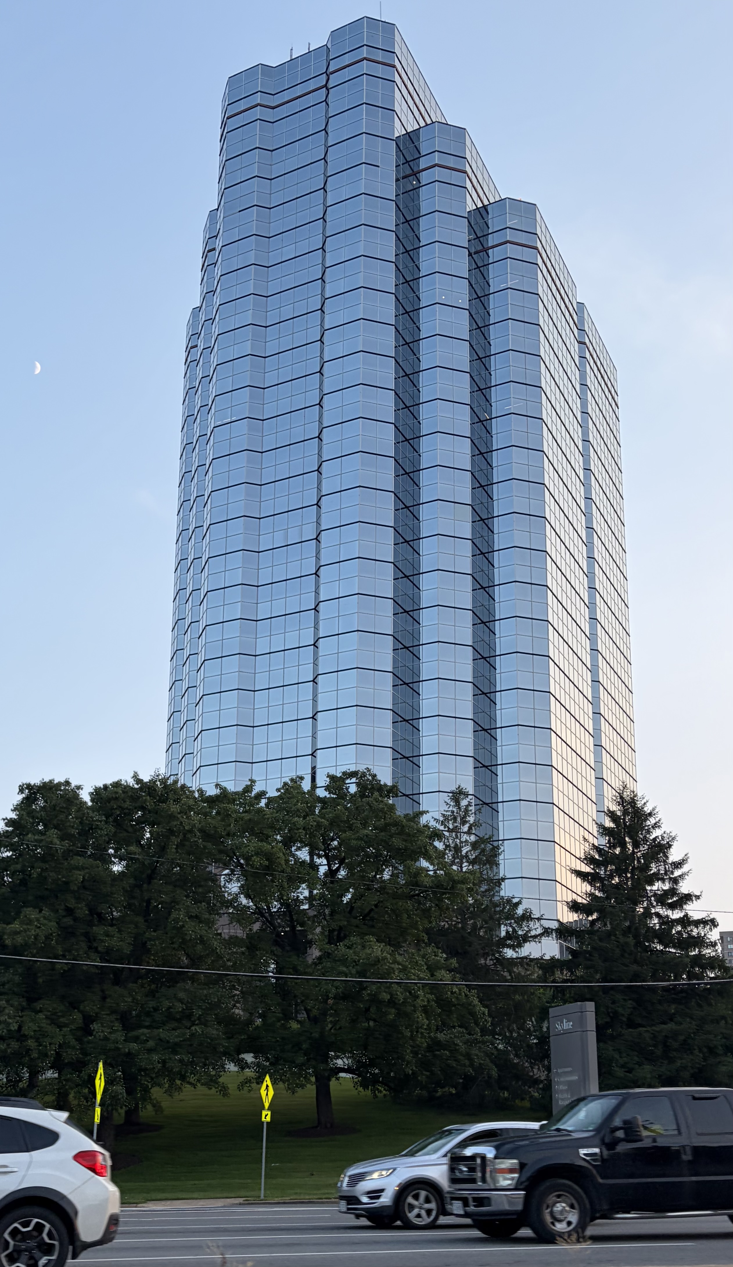
This is Bailey’s Crossroads in Fairfax County. A Falls Church postal address can be correct without placing the property inside the independent City of Falls Church. Skyline Center is the broader mixed-use development; Skyline Plaza and One Skyline Tower are individual buildings within that larger landscape.
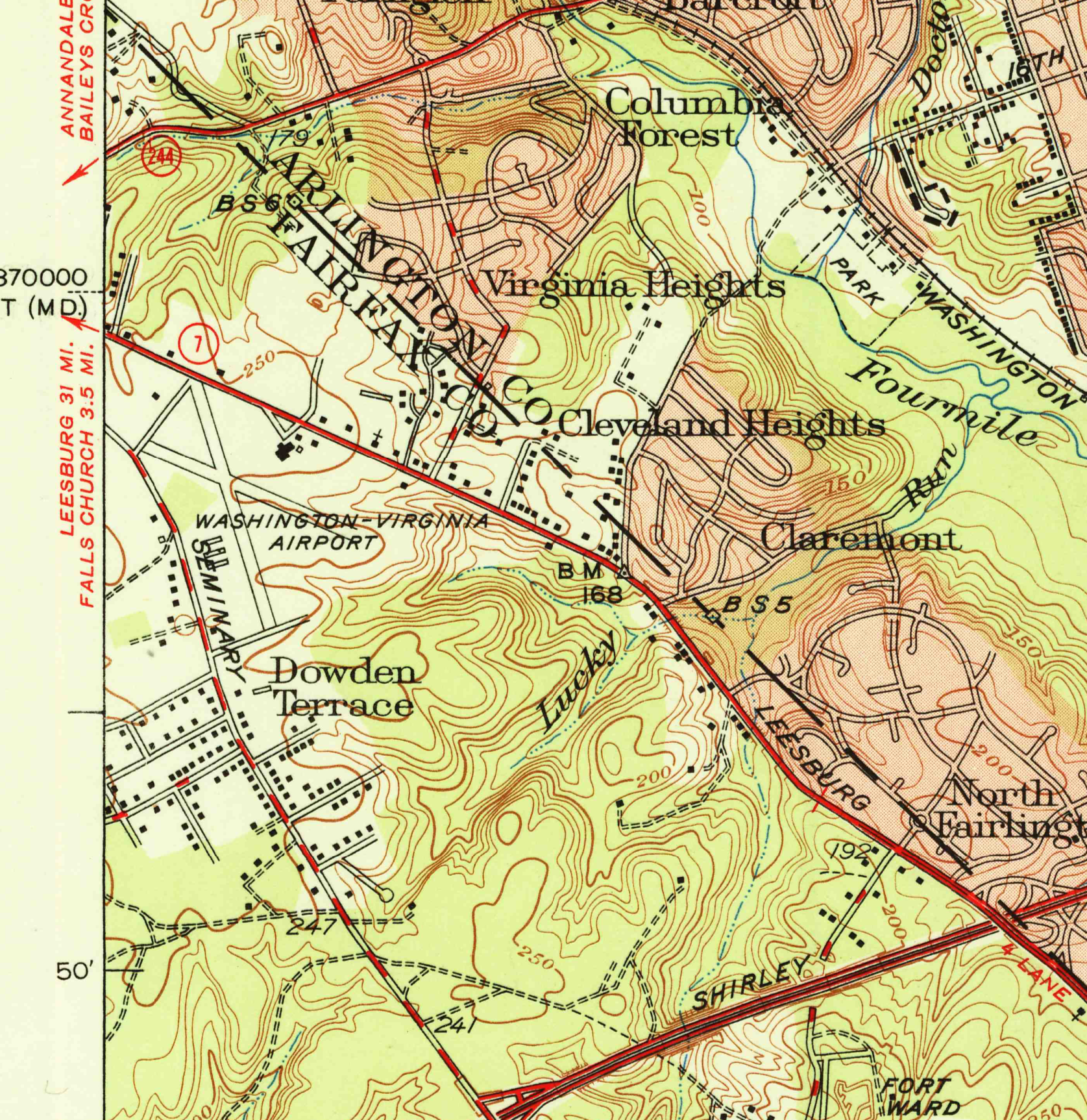
An old map makes the contrast immediate. The 1951 USGS Alexandria sheet labels the airport beside Leesburg Pike and Seminary Road. Compare that with the current locator. The same road names anchor a place whose use and vertical scale have changed dramatically.
Where to look today
A different kind of airport
Think flying lessons and private trips, not airline departure gates.
Washington-Virginia primarily served general aviation: flying outside the regular scheduled-airline system. Its everyday business included private pilots, instruction and charter service. Charter meant hiring an aircraft and pilot for a particular trip, rather than buying a seat on a regularly scheduled airline flight. Fuel, repairs and places to store aircraft made the field useful between flights too.
National Airport had opened in 1941, but that did not make this small field redundant. National was built with a passenger terminal and substantially longer runways. A local training airport offered a different setting for lessons, aircraft storage and short private trips. The distinction is purpose and scale; it does not require a claim that National banned every private airplane or flying lesson.
The 1947 aeronautical chart showed a 2,800-foot unpaved runway. That helps explain the scene: light aircraft, modest facilities and a field still developing after the war. Later charts and directories show changing lengths and surfaces, so one early measurement should not be treated as the airport’s permanent configuration.
The 1951 USGS map below is another piece of evidence, not a modern navigation guide. It labels the airport and neighboring roads. The western airfield edge meets the map-sheet boundary, so this detail cannot establish full runway lengths. Read it alongside the aerial photograph to understand how the field fit into the neighborhood.
The airport on a contemporary map
The people
The Benn family helped turn an open field into a flying community.
The airport did not have one tidy opening day. County records trace Germain’s land lease to 1941, Benn’s purchase to 1945 and expansion to 1946. The company charter is dated May 29, 1947. Land acquisition, licensing, incorporation and a working school were different milestones.
By 1947, the postwar school was welcoming former servicemen. The local historical account lists ten Piper J-3 Cubs among its 1948 training fleet. A Cub was a small two-seat airplane: the sort of machine in which a student could learn the basics beside an instructor, rather than an airliner carrying a cabin full of passengers.
Charles D. Benn’s Virginia aviation Hall of Fame biography adds a personal connection to that postwar moment. He had served as a flight engineer on B-17s and B-29s during World War II. The biography credits him and his brother with building Washington-Virginia after the war and records 25,000 hours of flight instruction across his career. That total covers his broader working life, not only this airport.
The field drew spectators as well as pilots. Writing for the D.C. Policy Center in 2017, David Rusk remembered childhood weekend visits with his father around 1950. They nicknamed the place after the children’s book character Pilot Small. It is a recollection, but a revealing one: watching little planes was itself a neighborhood outing.
Small aircraft, visible evidence
Neighbors at the runway
Yes, there really was a drive-in movie screen across the road.
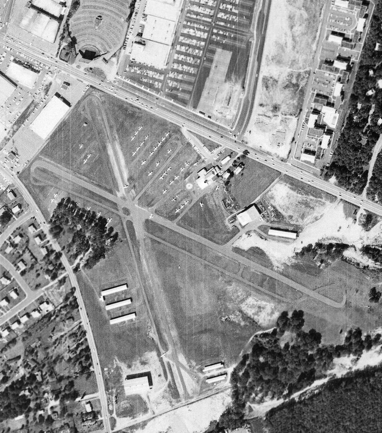
Across Route 7, the Sunset Drive-In became a real point of conflict. The airport sued in 1949, arguing that the screen and supports would obstruct flights near the runway. The theater defended its permit and disputed the clearance arguments.
County court records show a temporary injunction, competing evidence and the June 23, 1949 decision ending the injunction and denying a permanent one. Movies began that August. This was a documented conflict between neighboring uses, not simply a pilot’s tall tale.
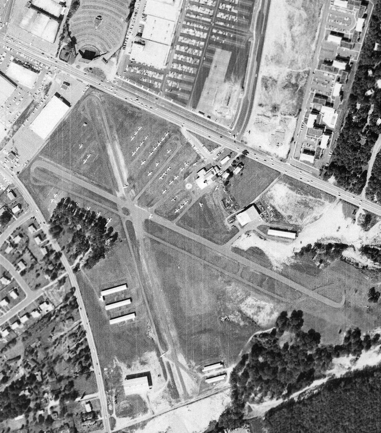
The 1964 aerial makes the relationship visible. An airport needs space around its landing and departure paths as well as on its own property. A busy road, a screen, utility lines and nearby buildings could affect those paths even while each neighboring property served a perfectly ordinary suburban purpose.
The last flights
The suburb grew around the airport. Then the land changed jobs.
Development brought obstacles and neighborhood friction to a field that depended on open land. Freeman’s history also identifies rising land values and taxes after John D. Benn Sr.’s death. These were contributing pressures, not proof that one event legally forced closure.
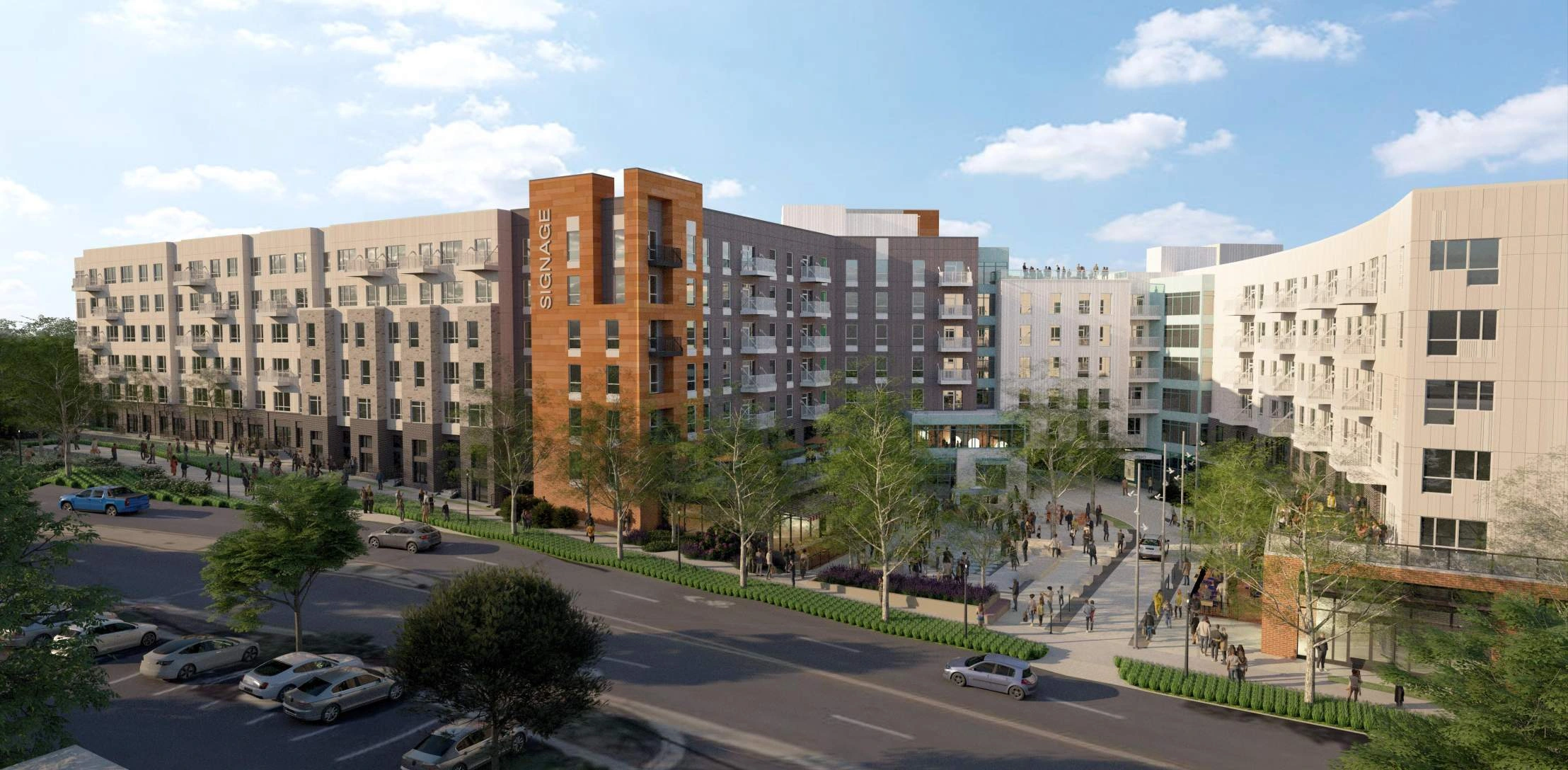
Richard Benn told Freeman that the family partnered with the Charles E. Smith Company to build Skyline Center. County records also confirm a development partnership. The land’s new purpose would be a dense combination of homes, offices and shops.
Freeman cites Virginia Airports by Vera Rollo and Norman Crabill for the October 18, 1970 closure date. A January 1971 Federal Register rule independently confirms closure and removes the airport’s access exclusion. It corroborates the period, not the exact October day.
Closing the airfield, starting construction and completing individual towers were separate milestones. It is tempting to turn them into a simple before-and-after date, but Skyline took shape in phases. Nothing in the evidence used here makes Dulles the cause of this airport’s closure.
The new Skyline
One airport site became a whole district of buildings.
Skyline Center aimed to combine residential towers with offices, shopping and other activities on a large shared site. Fairfax’s planning history describes the approximately 100-acre mixed-use center as a dominant feature of Bailey’s Crossroads. That figure describes the broader development, not a measured outline of the former runways.
A contemporary clue comes from the National Association of Convenience Stores. Its July 1, 1974 relocation notice announced new offices at 5205 Leesburg Pike in Skyline Center. The notice also described a much larger community expected by 1980. It proves offices were being occupied by 1974, while reminding us that a promotional plan is not a completed-building inventory.
Later transportation researchers described a superblock, meaning a large tract whose development was organized internally rather than divided by a normal network of through streets. Offices and retail occupied a central area, with residential towers around them. The site that once needed horizontal clearance for aircraft was being organized around tall buildings and their connections.
Local airport histories often give 1977 as Skyline’s completion date. A later transportation study still described the center as approaching build-out. Here, 1977 is best understood as a commonly reported development milestone, not proof that every proposed building, hotel or apartment in every early announcement had been delivered.
THEN · 1964
NOW · 2026
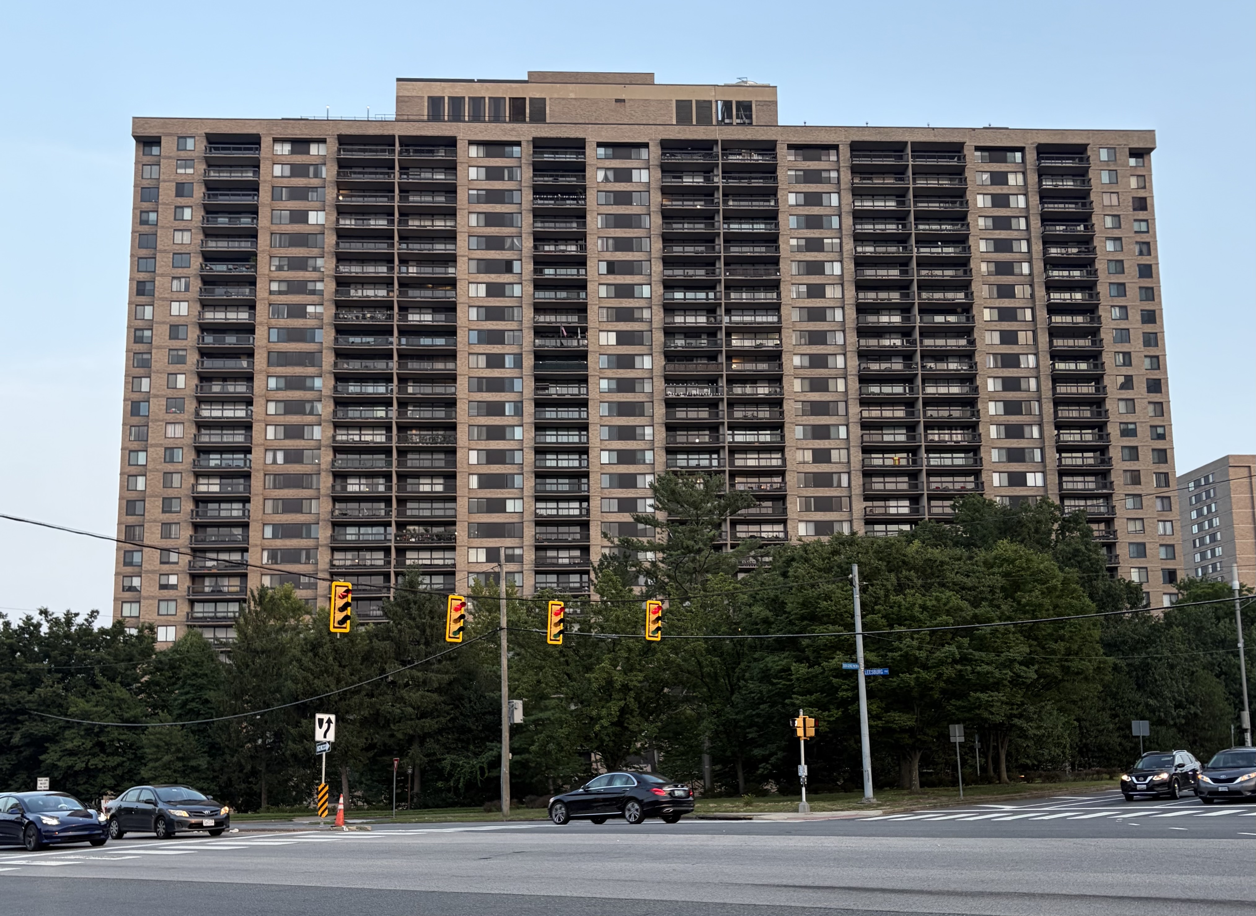
March 2, 1973
A construction tragedy is part of this history too.
On March 2, 1973, while Skyline was under construction, part of apartment building A-4 and its adjoining parking garage collapsed. Fourteen construction workers died. NIST’s historical overview records 34 injured. These were people working to build the new community, and their deaths deserve more than a passing footnote.
The National Bureau of Standards, the predecessor of NIST, investigated the failure. Its report identified premature removal of supporting forms as a contributing factor. Forms shape freshly poured concrete; temporary supports hold it and the construction loads above while the concrete develops enough strength.
The report’s analysis points to failure around columns at the 23rd-floor slab after support was partly or completely removed while the slab’s concrete was still relatively weak. Falling debris then overloaded floors below. The explanation concerns concrete strength, loads and the sequence of construction support. Calling it simply a bad concrete mix would miss the investigation’s central finding.
The investigation concerns a structure under construction in 1973. It is not a present-day condition assessment of existing Skyline buildings. Remembering this part of the redevelopment means being precise about what failed, and respectful toward the workers and families affected.
Look again
The next time you pass Skyline, picture the open sky.
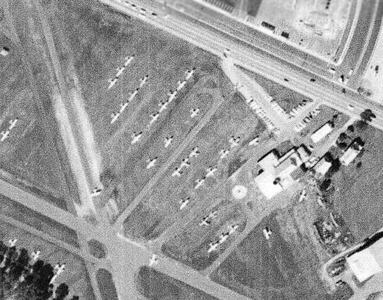
Put the aerial next to the modern photographs and the transformation becomes easier to grasp. The views are from different positions and dates, so they are not a precise overlay. They show a change in land use: intersecting runways and parked aircraft giving way to towers, streets, homes and offices.
Older accounts mention obstruction lights surviving on nearby buildings. Their continued existence has not been verified here. Treat those accounts as historical leads, not a current walking-tour promise. Start instead with the photographs, maps and records you can inspect.
Bailey’s Crossroads did not always look like the place we drive through today. Skyline is one especially visible chapter in that change. Once you know that little airplanes took off from this land, those familiar towers become a reminder of another way the neighborhood once worked.
| When | What happened |
|---|---|
| 1941 | Germain leased land for the airport’s beginnings. |
| 1945 and 1946 | Benn acquired and enlarged the airport property. |
| May 29, 1947 | Washington-Virginia Airport, Inc. chartered; postwar school operating by 1947. |
| June 23, 1949 | Court ended the injunction against the drive-in screen. |
| October 18, 1970 | Reported airport closure date; federal rule confirms closure by January 1971. |
| March 2, 1973 | Skyline construction collapse killed 14 workers. |
| July 1, 1974 | NACS announced its occupied Skyline Center offices. |
| 1977 | Commonly reported Skyline milestone; broader build-out continued. |
Another part of Skyline today
Why this matters locally
A familiar skyline can hide a very different neighborhood history. The airport’s story helps us see how people, small businesses and development decisions changed the same land over time.
Did you ever visit the airport, learn to fly there, or hear stories about it from your family?
Sources and further reading
Where the reporting comes from.
This article draws on public records, official statements, and attributed local reporting. Each link opens the original source.
- Records: Fairfax Circuit Court Historic Records Center, October 2018, deeds, charter and drive-in lawsuit ↗
- Place: Fairfax County Comprehensive Plan, Bailey’s Crossroads, 2018 historical edition ↗
- Map: USGS Alexandria quadrangle, 1951 edition ↗
- Local history: Franconia Museum’s collected airport account and postwar school ↗
- Airport context: Virginia Places, general aviation ↗
- Comparison: Metropolitan Washington Airports Authority, National Airport history ↗
- Archive: 1947 aeronautical chart and later runway records, reproduced in Freeman’s collection ↗
- Biography: Virginia Aeronautical Historical Society, Charles D. Benn ↗
- Recollection: David Rusk, D.C. Policy Center, childhood airport visits ↗
- Specialist history: Paul Freeman, photographs, attributed memories and closure date citing Virginia Airports ↗
- Photograph: September 26, 1964 USGS airport aerial, reproduced in Freeman’s collection ↗
- Federal record: January 16, 1971 Federal Register, airport access exclusion removed after closure ↗
- Contemporary record: NACS Skyline office relocation notice, July 1, 1974 ↗
- Development study: Transportation Research Board, NCHRP Report 294B, Skyline case study ↗
- Federal investigation: Leyendecker and Fattal, NBS Building Science Series 94, 1977 ↗
- Federal overview: NIST, Skyline Plaza Building Failure, Virginia, 1973 ↗
- Aircraft context: Smithsonian National Air and Space Museum, Piper J-3 Cub training design ↗
- Airport roles: Federal Aviation Administration, airport categories ↗
- Photo and reuse: Dclemens1971, Skyline Plaza, July 20, 2026, CC BY 4.0 ↗
- Photo and reuse: Dclemens1971, One Skyline Tower, July 20, 2026, CC BY 4.0 ↗
- Photo license: Creative Commons Attribution 4.0 International ↗
- Locator geography and license: OpenStreetMap contributors, ODbL ↗
- Federal imagery reuse: USGS copyrights and credits policy ↗