The local story
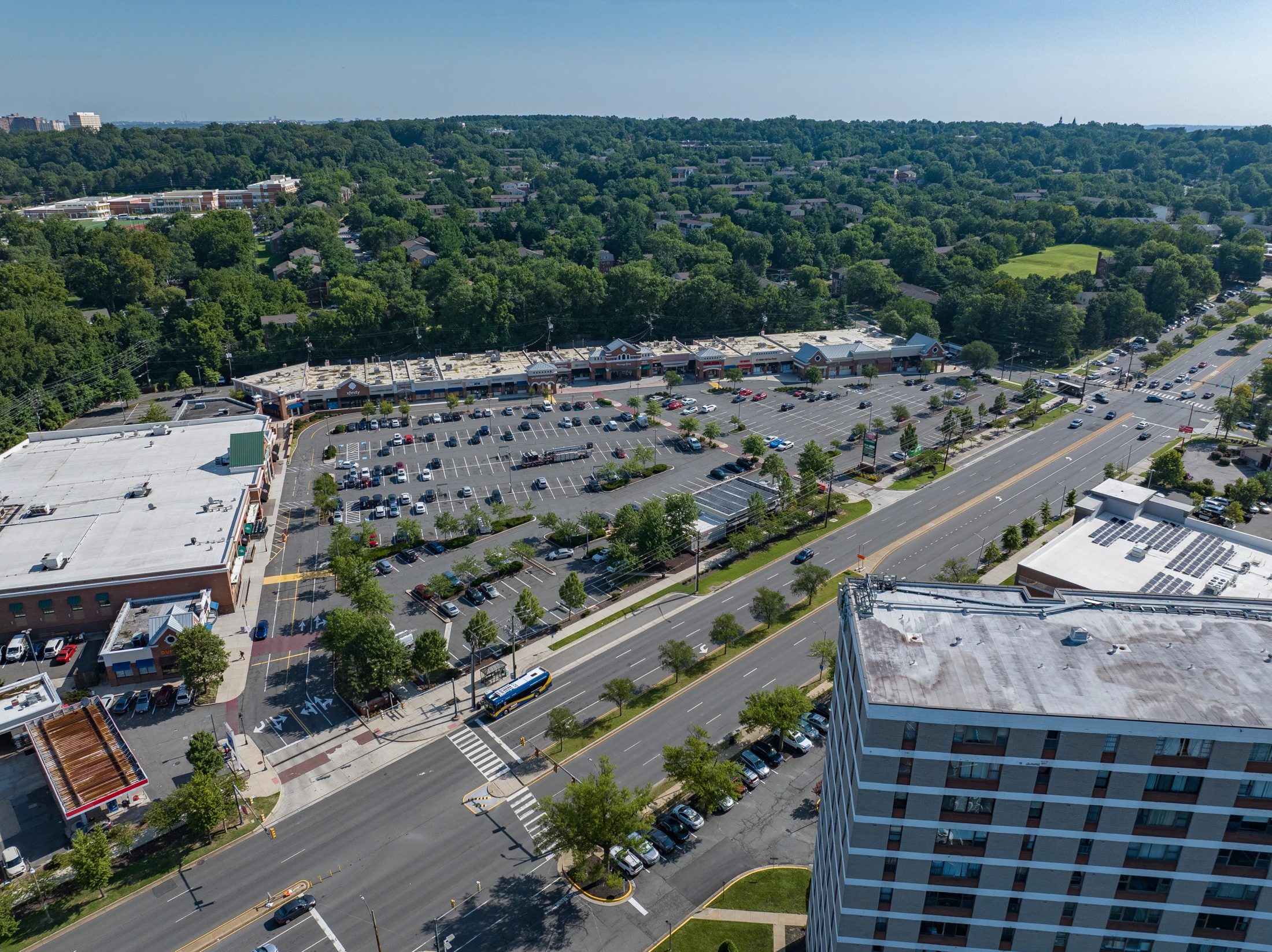
Duke Street is many places at once: a route across Alexandria, a collection of shopping centers, a home for small businesses and the street people need to cross to reach the other side of their neighborhood.
Alexandria’s draft land-use plan asks what those places could become together. Released September 29, it covers the corridor from Alexandria Union Station to Van Dorn Street and the West End development. Twelve districts organize the proposal, with a roughly 20-year planning horizon.
The maps show possibilities and proposed requirements. They do not mean individual buildings have been approved, that every property will redevelop or that construction starts on a single timetable. Information and participation details checked October 16, 2026.
Your voice
November 13 matters, but comments do not end there.
Submit feedback by Friday, November 13 if you want it considered for incorporation into the updated draft prepared for the December hearings. The city says later comments will still be accepted and shared with the Planning Commission and City Council, although they cannot be incorporated into that docketed draft.
As of October 16, the project page describes December public hearings but does not give a confirmed Duke-specific date, time, location or speaker-registration deadline. General meeting dates alone do not establish that this plan is on a particular docket.
| Route | What to do |
|---|---|
| Online feedback | Use the draft-plan Engagement Hub. Identify a district, page or recommendation. |
| Email or phone | Christian.brandt@alexandriava.gov · 703-746-3859 |
| Zoom office hours | Next confirmed session: November 4 at noon Eastern. The October 20 and 26 sessions have passed. Register and confirm any later session on the city project page. |
| December hearings | Dates and case-specific arrangements still need an official notice. Recheck the city project page. |
The long view
A connected corridor, not a single construction project.
The city’s September 29 presentation summarizes proposed network and open-space targets. They should be judged together: a park is more useful when someone can reach it comfortably, and a new route matters most when it connects to somewhere people need to go.
The draft describes investment and development over twenty-plus years, with timing dependent on markets and individual decisions. A planning target is not a funded delivery commitment.
| Measure | Proposed amount | How to read it |
|---|---|---|
| Planning horizon | About 20 years | Long-term framework, not a completion promise |
| Districts | 12 | Different places receive different guidance |
| New parks and open space | Approximately 9 acres | Plan-wide target |
| New bicycle facilities | 4 miles | Proposed connections, not facilities already built |
| New trails | 1.25 miles | Separate from the bicycle-facility figure |
| New streets | 1.8 miles | Part of the proposed network |
Get your bearings
Start with your district.
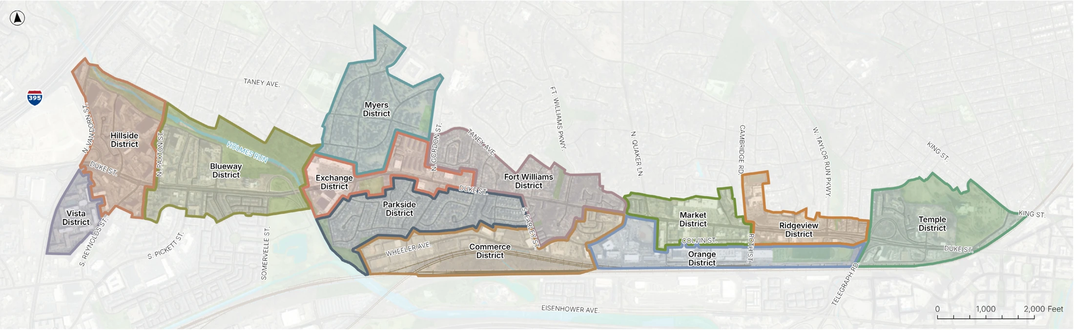
The full district map is the best place to begin. Find the property, shopping center or crossing you recognize, then open its district chapter in the draft. The corridor runs between Union Station at the eastern end and Van Dorn Street at the western end.
Different districts have different existing uses and proposed guidance. Reading a single building diagram without the district map can hide the surrounding street, park and retail relationships.
Foxchase example
An illustrative plan explains relationships, not a guaranteed building.
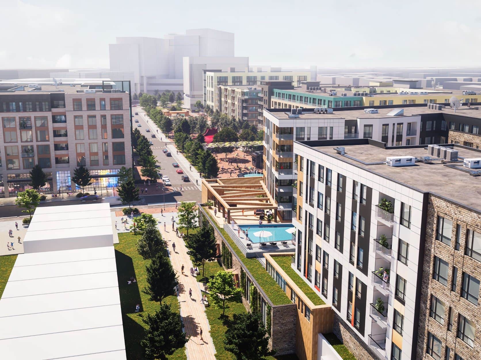
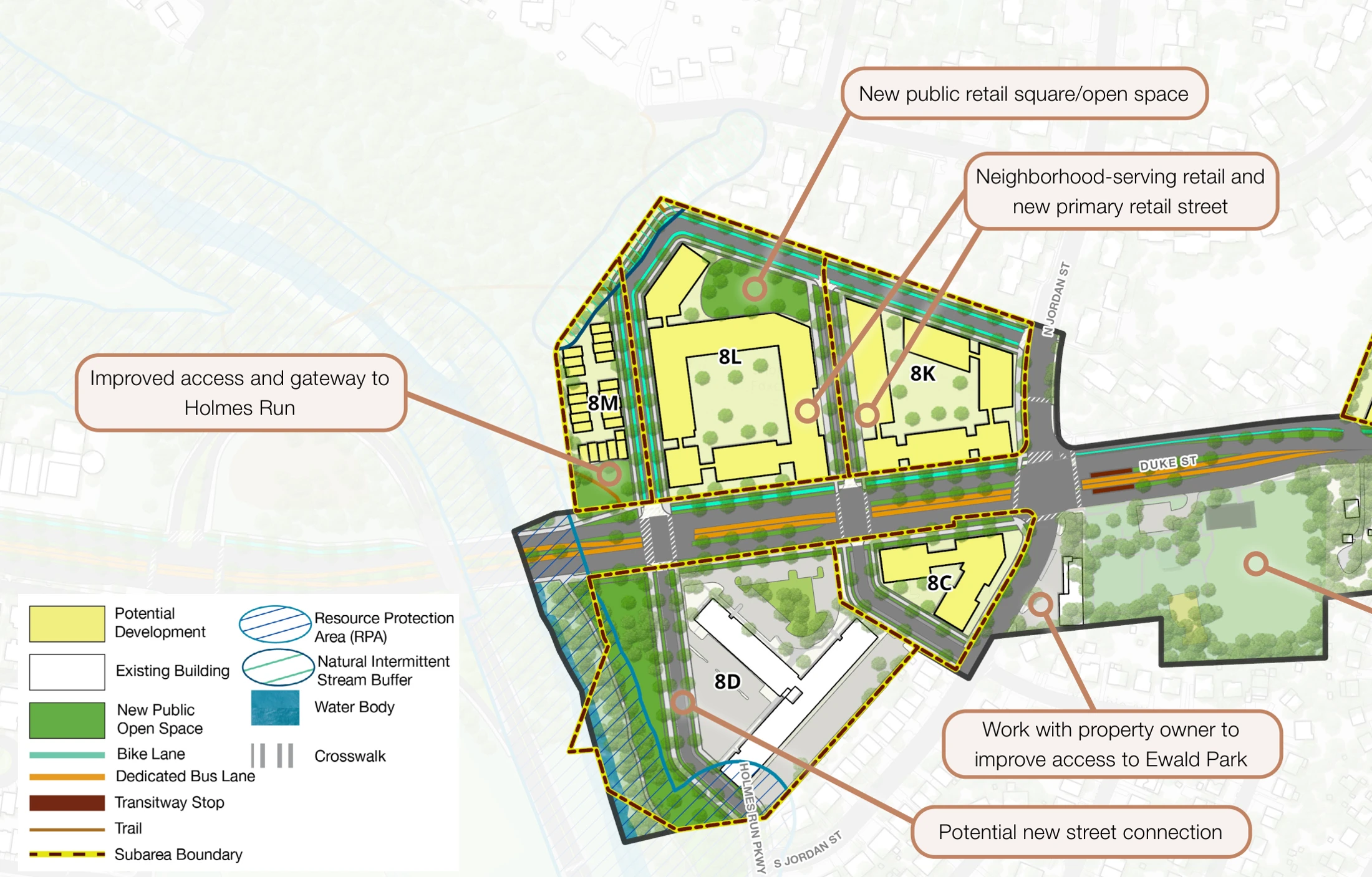
The Exchange District around the Shoppes at Foxchase is a useful example. Its draft guidance considers a predominantly residential mixed-use area while addressing retention or replacement of retail, a full-service grocery and open space. The accompanying concept drawing is illustrative; the draft explicitly allows the final configuration to vary.
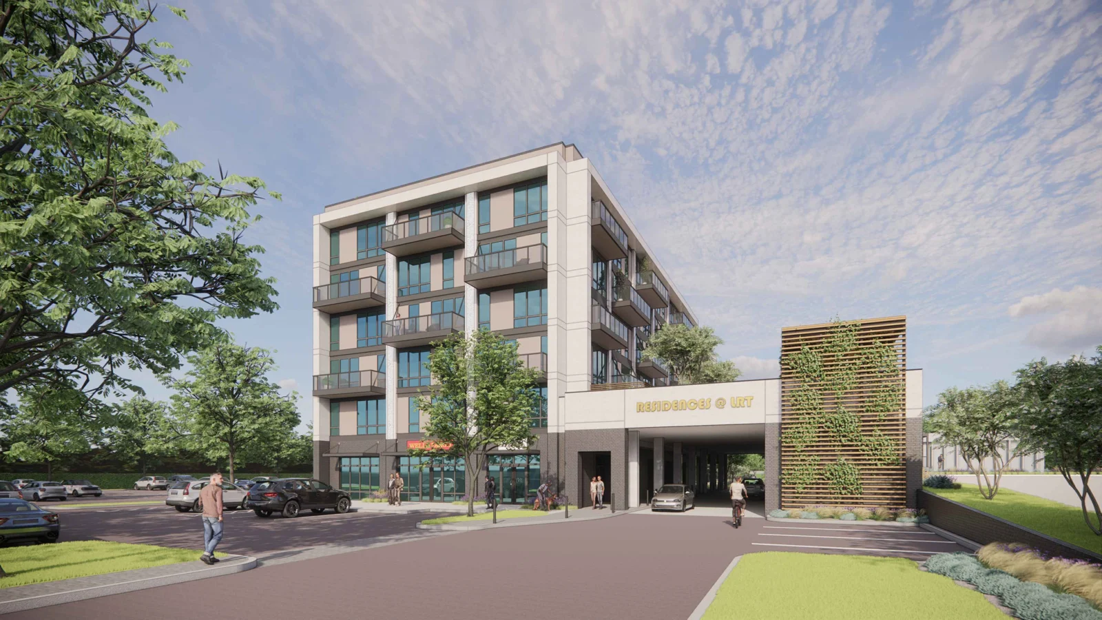
That distinction matters when looking at a compelling drawing. It can explain the relationship between buildings and public space without establishing the precise building that will be constructed. For someone who shops here, the practical question is how everyday services remain accessible as properties change.
Streets and limits
What the plan can change, and what follows a separate process.
The city describes this as an overlay plan. It would guide land-use decisions within its boundary while retaining existing small-area-plan guidance where the overlay does not address an issue.
It does not require owners to redevelop. It also does not reopen the separately approved Duke Street Transitway concept. Those distinctions separate a long-term land-use discussion from transportation projects moving through their own processes.
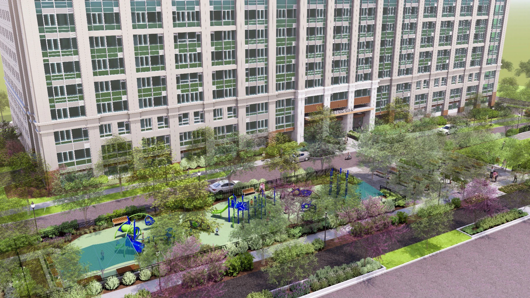
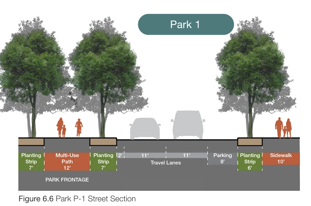
The proposed street sections help explain how movement, trees and building edges could fit together. They are useful for asking about walking comfort and connections, but do not establish a construction date for a particular block.
Make it useful
A strong comment needs a place, a concern and a requested improvement.
A useful comment does not need planning jargon. Identify a crossing where you want a safer connection, explain which everyday shopping trip needs to remain practical during redevelopment, or point to a proposed park and ask how people will reach it.
You can identify a district recommendation you support or want revised, then ask what should happen first and how later phases depend on it. A location and a concrete request give staff something to evaluate against a map or recommendation.
The near-term question is how public feedback changes the draft before the hearings. The longer-term questions concern adoption, implementation and the sequence of individual investments. Watch usable open space, retained daily services, street connections and the terms attached to future development.
Why this matters locally
The plan could shape how Duke Street’s neighborhoods connect over decades. The current feedback period is a chance to influence that framework before individual projects define the details.
Sources and further reading
Where the reporting comes from.
This article draws on public records, official statements, and attributed local reporting. Each link opens the original source.
- City of Alexandria: Duke Street Land Use Plan and participation updates ↗
- September 29, 2026 public draft: district guidance, street sections and implementation ↗
- September 29 community presentation: draft-wide targets ↗
- October 9 city notice: feedback deadline and later comments ↗
- Full labeled district map ↗
- City FAQ, updated September 2026 ↗