The local story
At the northern end of Alexandria’s waterfront, the old power plant occupies land that most people have never been able to explore. The redevelopment plan would turn that industrial property at 1300 North Royal Street into part of Old Town North, with homes, shops, new streets and public places beside the river.
The change is bigger than replacing smokestacks with apartments. An entire neighborhood needs to be built around land with an industrial past. Here is what the current approvals actually allow, what the public would receive, and what still has to happen. Reporting checked October 6, 2026.
At a glance
A large vision, with a smaller first step.
The full development framework and the first building approvals answer different questions. The framework sets the outer limits of what the site can accommodate. Individual permits decide what particular blocks can contain. Neither means the finished neighborhood already exists.
Find the site
North of Old Town, beside the river.
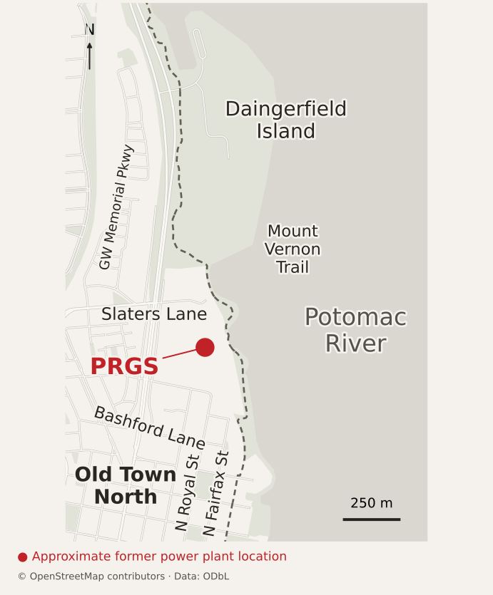
The property lies south of Slaters Lane and west of the Potomac waterfront. The Pepco substation borders its western side, while railroad land borders the southern edge. North Royal Street supplies the familiar address, but this is a much larger property than an ordinary street-front building.
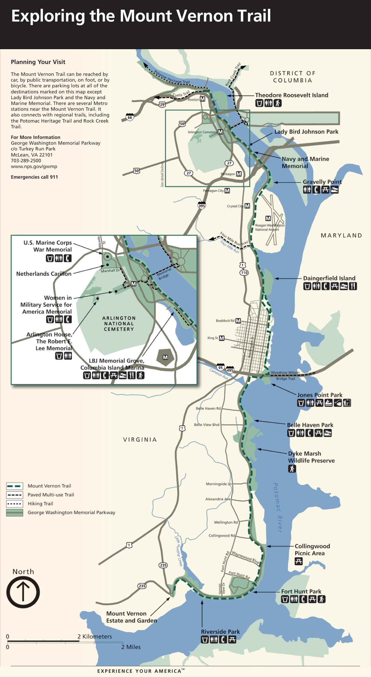
The Mount Vernon Trail runs along neighboring National Park Service land. That distinction matters: the developer’s property and the federal waterfront corridor have different owners and approval processes. Connecting them takes more than drawing a path on a rendering.
Use the locator to place the site in the neighborhood, then open the official plan for the proposed internal layout. A location point identifies the project; it does not establish a legal property boundary.
Place the project in Old Town North
The industrial past
Electricity came first. The waterfront came later.
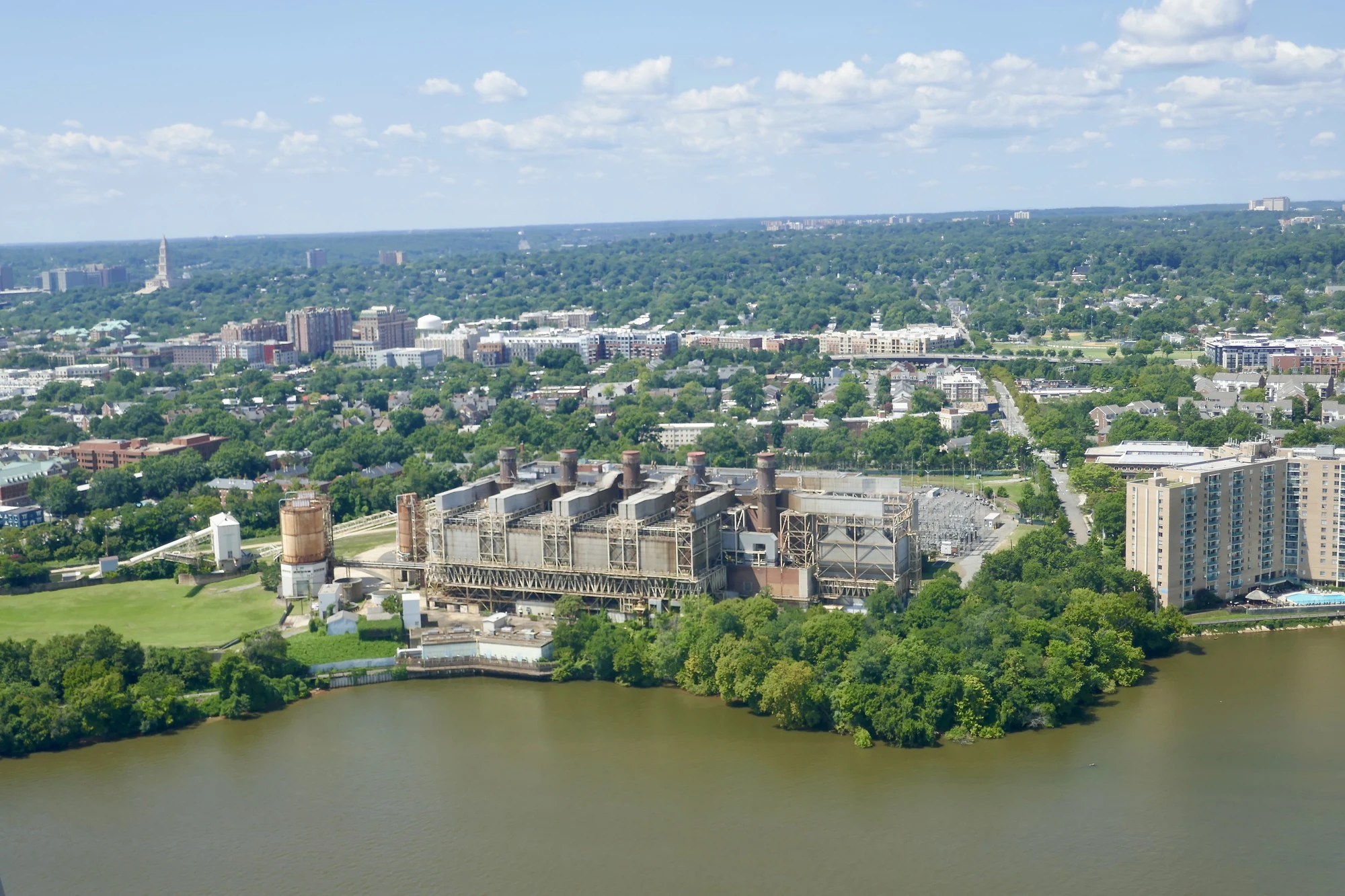
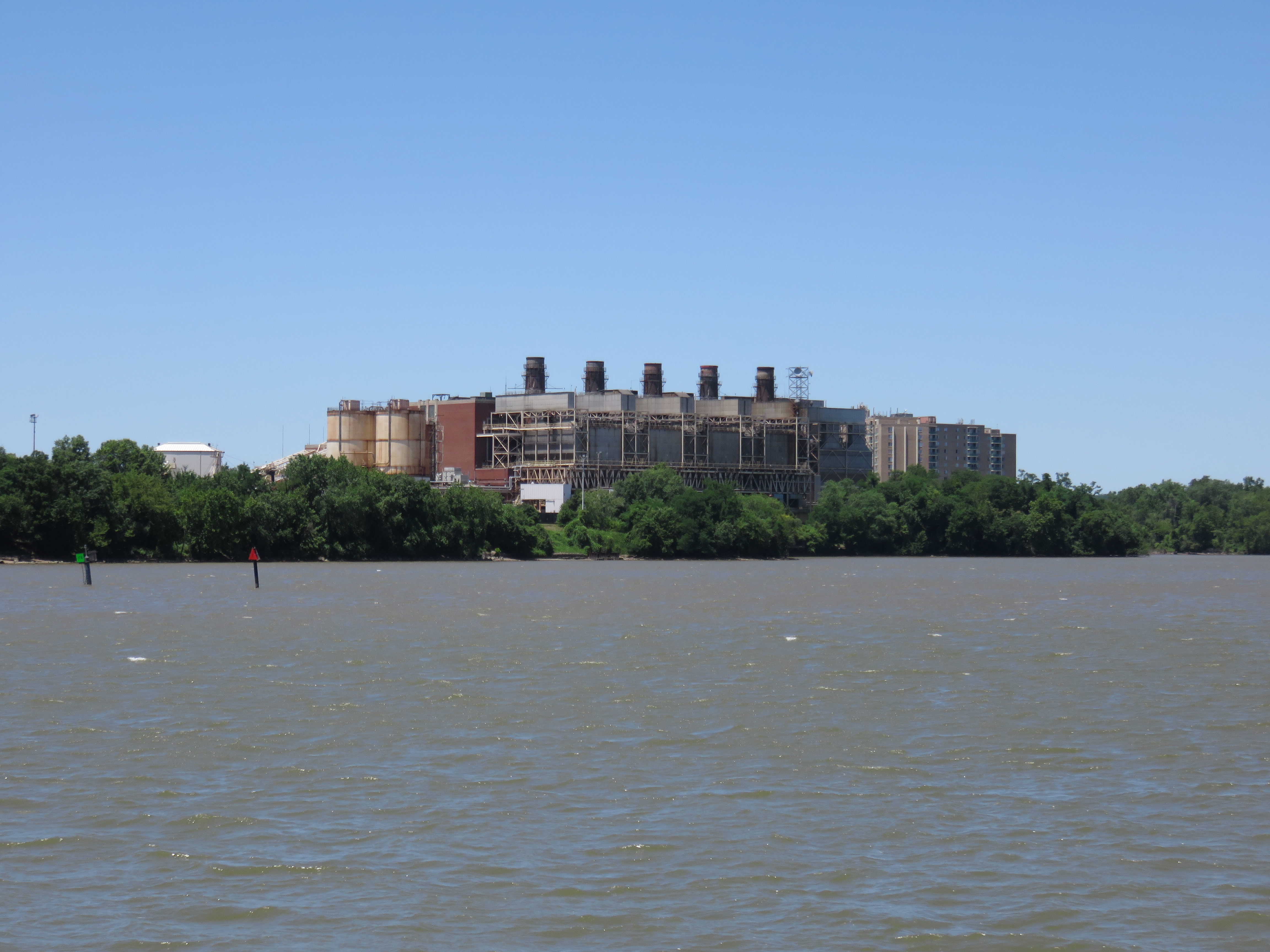
The generating station began operating in 1949 to help serve the Washington region. Coal-fired generation needed boilers, turbines, fuel handling and substantial industrial infrastructure. The riverfront became a working utility site rather than a place designed for public recreation.
Closure followed years of residents’ organizing and government action over air pollution. Alexandria’s archive documents a 2004 policy to seek cleanup in the short term and permanent closure in the long term, followed by tighter controls and a negotiated shutdown. Electricity generation ended October 1, 2012.
HRP acquired the property in November 2020. By then, turning off the plant had ended its generating role, but had not prepared its buildings and ground for a residential neighborhood. The physical legacy remained. That is why the redevelopment story begins with assessment and controlled removal, not simply a demolition date.
The industrial waterfront before redevelopment
The approved neighborhood
Read the blocks before counting the towers.
The plan organizes the property into development blocks A through F, with an internal street network and park connections. On sheet A300, the white block shapes identify development areas. They are not exact final building footprints. The colors and legend explain when different open spaces would be delivered.
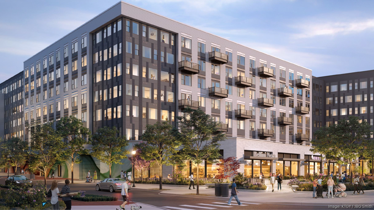
June’s residential approvals cover Blocks B and C. Each combines rental and condominium housing with commercial space at ground level. Their towers reach up to 16 stories and 172 feet, with rooftop equipment treated separately. Block B’s rental portion also has a lower, 12-story wing. Heights come from the approved documents, not estimates from pictures.
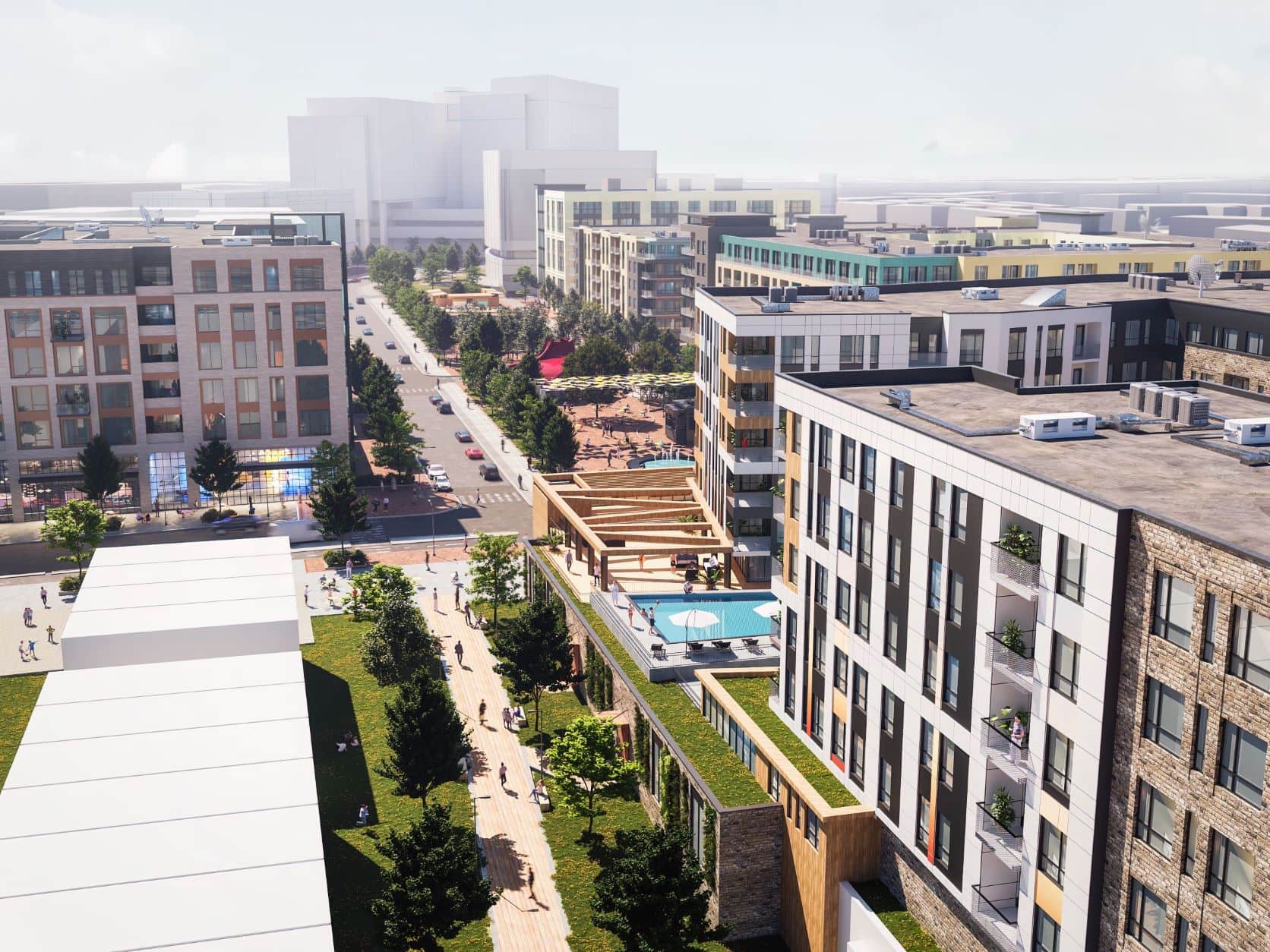
New street connections would extend North Fairfax and North Royal into the site and link toward Slaters Lane. A woonerf is a shared street designed to give pedestrians priority. The proposed waterfront section uses that idea to connect buildings, outdoor activity and parks. Railroad-related connections require Norfolk Southern approval.
Commercial space creates room for shops or restaurants, but the records reviewed do not establish a final tenant list, prices or leasing dates. Block A also still needs its future use and design advanced. A planned mixed-use district is a framework for activity, not a directory of businesses already signed.
| Approved block | Homes | Height / form |
|---|---|---|
| B | 321 | Up to 16 stories / 172 ft; rental wing steps to 12 stories. |
| C | 494 | Rental and condominium towers up to 16 stories / 172 ft. |
Housing commitments
Affordable homes come through different routes.
The amended approvals call for at least 58,333 square feet of affordable set-aside housing throughout the development, estimated at roughly 60 homes. Blocks B and C include 19 of those rental homes: eight in B and eleven in C, serving households at 60 percent of area median income. These units are distributed within the rental buildings.
Area median income is a regional benchmark used to set eligibility and affordable housing limits. It is not the same as the income of an individual household. These approvals do not establish a public application window today.
A separate partnership could produce up to 100,000 square feet, approximately 100 homes, in an affordable building during later phases. That requires a partner, financing and further agreement. Together, the two approaches explain the commonly cited roughly 160 affordable homes. They do not mean 160 fully funded units are already under construction.
The strategy also includes Housing Trust Fund contributions. The documents allow those contributions to support the proposed partnership under city oversight. The important question is how the later building becomes deliverable, alongside the commitments attached to the market-rate phases.
The public waterfront
The parks are intended for everyone.
Waterfront Park and Rail Corridor Park are approved as publicly accessible parks on private land, protected by public access easements. An easement gives the public enforceable access rights without changing who owns the underlying property. Residents of the development would not be the only people allowed to use them.
The two named parks total about 4.75 acres. Adding the Waterfront Plaza brings the site’s publicly accessible parkland above five acres. HRP’s broader figure of more than ten acres includes new or improved space beyond the plant property, including federal land. Those are different measurements, not competing counts of the same on-site park.
Waterfront Park emphasizes river views and connections; Rail Corridor Park provides a flatter setting for play areas, recreation and gathering. The drawings show the intended character. Pools and rooftop amenities in the residential blocks are a separate category from these public spaces.
The parks would open in portions linked to development-block milestones, rather than waiting for every building. The amended conditions tie public-space delivery to residential occupancy. That makes the phasing plan worth following alongside the architecture.
NPS is separately reviewing changes to the Mount Vernon Trail and Parkway area, including safer crossings, trail improvements and waterfront access. The initial federal comment period closed February 12, 2026. Its document list did not show a later draft assessment when checked for this article. City park approval does not substitute for the federal process.
One site in a regional trail network
Cleanup first
A controlled sequence, with some overlap.
Abatement means removing regulated materials from the buildings before taking the structures apart. HRP’s June FAQ identifies asbestos, lead paint and PCBs among materials requiring controlled handling. The process includes inspections and clearance letters before mechanical deconstruction can proceed.
The May 2024 remediation plan places the site in Virginia’s Voluntary Remediation Program under Department of Environmental Quality oversight. It proposes soil removal, engineered cover and controls that limit contact with remaining impacted material. A historical petroleum release is handled separately through the state’s storage-tank program. Plans and monitoring do not establish that residential cleanup is complete.
The May 2024 perimeter dust plan calls for six real-time monitors, action thresholds and corrective measures if readings trigger them. It also calls for monthly monitoring reports on the project website. Those reports will be useful evidence once construction activity begins.
The sequence is not a rule that every inch of the site must be finished before any building starts. HRP says initial building work can overlap with plant removal in separate areas. Council’s amended conditions prohibit occupancy in B or C until the above-ground plant is fully abated and removed.
The sequence below is an explanatory guide, not a binding construction schedule. Separate areas can advance at different times.
The $135 million
Infrastructure financing, repaid over time.
Council approved a $135 million tax increment financing package in June. It supports eligible site preparation and public infrastructure, including plant removal, environmental work, streets and open space. The amount is neither the whole redevelopment budget nor a direct payment to build private apartments. The term sheet describes $135 million in net infrastructure proceeds. Bond issuance costs, reserves and interest can make total borrowing and repayment larger.
Tax increment financing uses a share of tax revenue generated above an agreed starting level to repay financing for improvements. Here, the intended repayment sources include eligible new real estate, sales, meals and hotel taxes associated with the project. Other revenue remains available for city services.
The approved framework uses revenue bonds and a Community Development Authority, with potential assessments on project property if the specified tax revenue falls short. This differs from pledging the city’s full faith and credit through ordinary general obligation debt. It still commits future revenue to repayment, so the assumptions matter.
The nonbinding term sheet anticipates $70 million for the first phase, with later funding dependent on performance. The developer funds work upfront; reimbursement follows verified eligible work and proposed milestones. Council authorized negotiation and execution of implementing agreements and a later ordinance process for the authority. These terms form a framework for future agreements, not proof that binding agreements are complete or bonds have been issued.
Timing and next steps
2027 is an expectation, not a finished date.
HRP’s June announcement anticipated groundbreaking in 2027. Its updated FAQ is more specific about plant deconstruction: the second half of 2027, contingent on final infrastructure approval, abatement permits, inspections and subsequent removal permits. The records reviewed do not confirm that demolition has started as of October 6, 2026.
The nonbinding financing term sheet proposes performance deadlines, conditions and possible extensions for future agreements. Those targets are not guaranteed move-in dates. Full buildout will occur through multiple phases, and later blocks still have further decisions ahead.
| Milestone | Status and meaning |
|---|---|
| October 1, 2012 | Completed: electricity generation ceased. |
| November 2020 | Completed: HRP acquired the site. |
| July 2022 | Approved: overall CDD development framework. |
| June 2023 | Approved: infrastructure development site plan. |
| June 2026 | Approved: B/C, two parks and financing framework. |
| 2027 | Anticipated: groundbreaking; deconstruction projected for second half, subject to prerequisites. |
| Later phases | Future: additional blocks, park sections and affordable partnership. No guaranteed full-buildout date. |
What to watch next
Watch for final infrastructure plan release and abatement permits, followed by a dated deconstruction notice. Follow the authority ordinance, executed financing agreements and bond decisions. Look for the NPS draft assessment and a new comment opportunity, plus firm commitments for the later affordable building. City and HRP document pages are linked below so readers can check these milestones directly.
Old Town North
More access, and a long construction transition.
The most visible potential benefit is reconnecting a closed industrial property to the neighborhood. More homes, public riverfront space and streets could turn a barrier into a place people use. The measure of success will be what opens and how well it connects to the surrounding area.
The transition also brings practical questions. How will trucks reach the site? Where will workers park? How will dust readings, noise and temporary trail changes be communicated? May’s public Q&A records questions about these issues. HRP said construction access plans were still being finalized; the approvals require construction management and worker-parking arrangements.
Affordability deserves the same follow-through as the park renderings. Which homes are delivered with each phase, and when does the separate partnership secure its funding? Retail activity, traffic and public access also need to be judged against actual plans and completed work. Nearby property values cannot be predicted from an approval.
For now, the useful distinction is between a vision that has cleared important votes and a neighborhood that remains to be built. Follow the permits, opening requirements and public commitments as carefully as the pictures.
Quick answers
Six questions people ask about the plant.
Where is the old Alexandria power plant?
At 1300 North Royal Street in Old Town North, south of Slaters Lane and beside the Potomac waterfront.
Is it still operating?
No. Electricity generation ended October 1, 2012.
Has demolition started?
No dated source reviewed confirms a start. HRP’s June 2026 FAQ anticipates deconstruction in the second half of 2027, after prerequisites.
How many homes are planned?
The full-site framework allows up to 2,000. Blocks B and C currently have approvals for 321 and 494, totaling 815.
Will the waterfront parks be public?
The approved parks use public access easements on private land. They would open in phases. Improvements on NPS land require the separate federal process.
When could construction begin?
HRP anticipated groundbreaking in 2027. That projection is conditional and is not a guaranteed opening or full-buildout date.
Why this matters locally
Old Town North could gain a waterfront neighborhood where a power plant once cut off public access. The public benefits will depend on cleanup, enforceable commitments and what each phase actually delivers.
What would make this waterfront most useful to you: better trail connections, public gathering space, more housing, or something else?
Sources and further reading
Where the reporting comes from.
This article draws on public records, official statements, and attributed local reporting. Each link opens the original source.
- City planning approvals, updated September 4, 2026 ↗
- City financing overview, including June 13 approval and older preliminary material ↗
- Final CDD plan posted August 2026; sheet A300 on PDF page 22 ↗
- June 13 adopted action: Blocks B and C and amended CDD conditions ↗
- June 13 adopted action: Waterfront and Rail Corridor parks ↗
- Council financing item 26-1009, adopted term sheet and signed resolution ↗
- Term sheet attached to the June 13 Council resolution ↗
- Signed Council resolution authorizing the financing framework ↗
- HRP first-phase approval announcement, June 2026 ↗
- HRP June 2026 FAQ: deconstruction, permitting and projected timing ↗
- HRP May 26, 2026 community questions and answers ↗
- City archive documenting the October 1, 2012 closure ↗
- City and GenOn closure agreement announcement, August 2011 ↗
- NPS Old Town North environmental assessment project ↗
- NPS public scoping record: January 12 to February 12, 2026, now closed ↗
- Ramboll perimeter dust monitoring plan, May 2024 ↗
- HRP project document library and community updates ↗
- Ifly6 former plant photograph, August 22, 2024 ↗
- Creative Commons Attribution-ShareAlike 4.0 image license ↗
- OpenStreetMap data attribution and license ↗
- Ramboll remedial action plan, May 2024: proposed remedies and DEQ programs ↗
- Antony-22 plant photograph, June 11, 2019 ↗
- NPS Mount Vernon Trail regional map, 2021 file version ↗
- NPS federal-work and third-party content policy ↗